WALK: Llanberis Path, Yr Wyddfa (Snowdon), Gwynedd
The roof of Cymru
There are six routes up Yr Wyddfa, the most popular of which is the well-graded Llanberis Path. However you get there, the views of the surrounding mist-shrouded mountains are astonishing, says Julie Brominicks
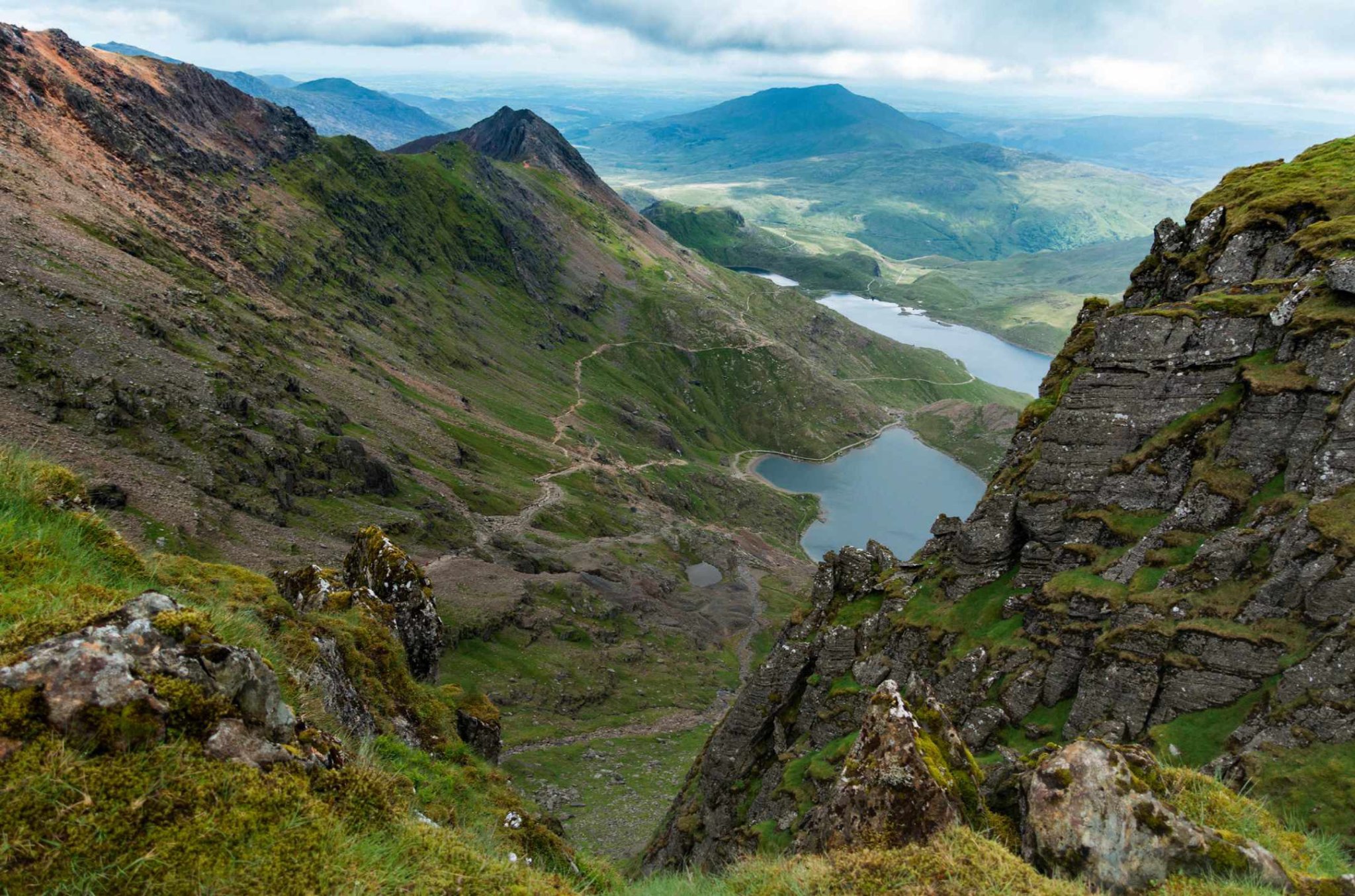
It seems I have the summit to myself. “Yr Wyddfa,” I say, grinning stupidly. Any mountain makes me euphoric, this one especially so. For a special few moments I stand alone at the apex of Cymru. Or not alone, as it transpires. A herring gull hunkers here too, grumpy but not incongruous. Cold mizzle slaps my face and the entire squally summit, with rocks and ghostly figures looming through swirling cloud, resembles a shipwreck. The figures slowly materialise, grinning and whooping. There is always a party atmosphere on the top, even when, like now, the weather (which only 24 hours earlier was forecast to be light snow and sun) has closed in – vanishing the fabulous views of north Cymru into a theatre of mist.
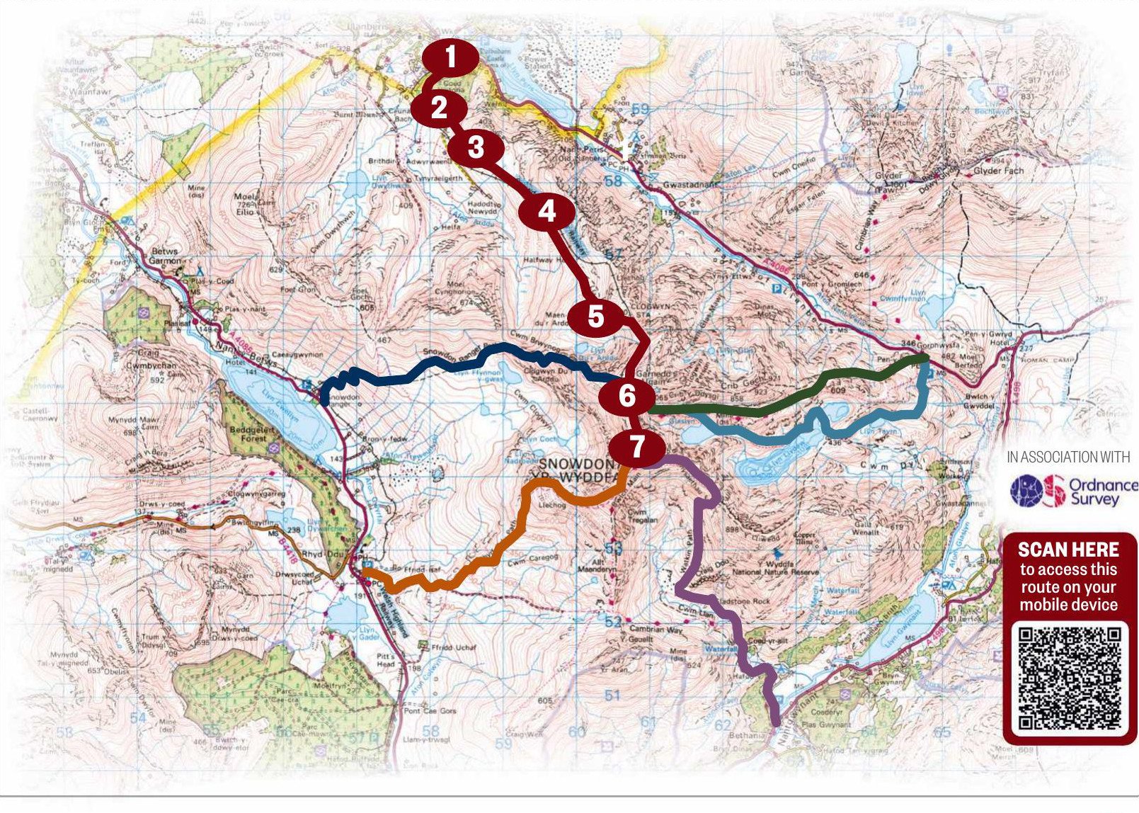
1 ON YOUR WAY
The longest, steadiest and most easily navigable route up Yr Wyddfa begins at the end of Victoria Terrace opposite the Victoria Hotel in Llanberis. Ascend the steep lane beyond the cattle grid.
2 PAST THE TEA HOUSE
Pass characterful Pen-y-Ceunant Isaf Tea Rooms. A warm Welsh welcome is guaranteed at any time of year but is particularly special off-season when you might get the open fire and Steffan’s hospitality to yourself.
3 OFF-ROADING
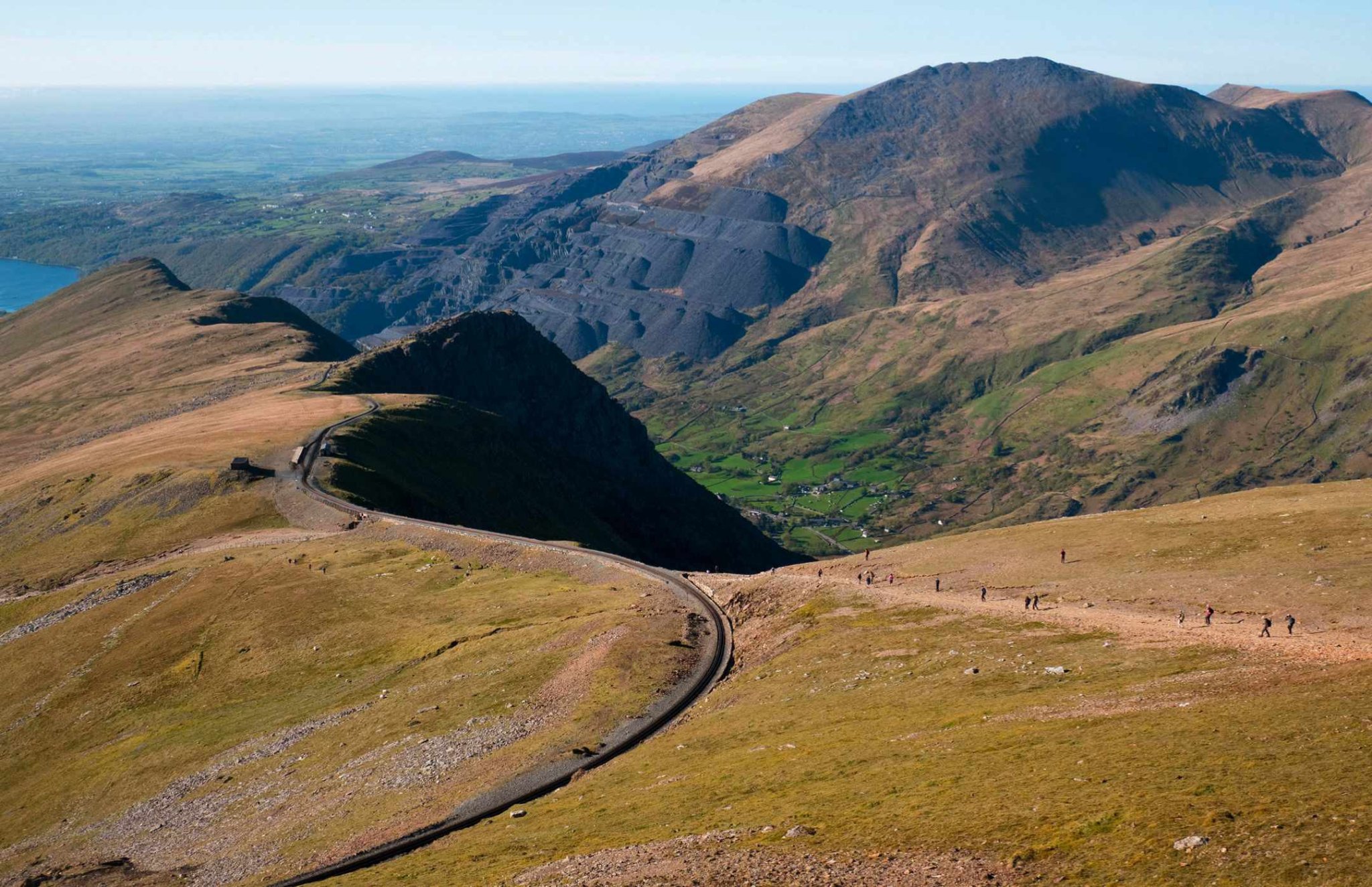
Continuing uphill, turn left off the road on to the waymarked path. Note the mountain railway, below right, whose rack and pinion track has been conveying passengers since 1896.
4 HALFWAY HOUSE
Halfway House is open in the summer months for basic refreshments. From here on the path is steeper and the weather less predictable, so it’s a good place to turn back if you’re feeling wobbly.
The path up Allt Moses is steeper and bouldery. In clear weather the vista opens out, revealing Glyder Fawr ahead.
5 UNDER THE LINE
Pass under the railway near Clogwyn Station. The bridge provides your last shelter, so is a good place to don extra layers in inclement weather.
While views down to Cwm Glas Bach are gorgeous, this section is cut into a steep slope so can be lethal if filled with snow.
Continue to take great care as you bear right on to Carnedd Ugain overlooking Clogwyn
Coch. The path here is less well defined but marked by cairns.
6 MEETING OF TRACKS
At Bwlch Glas, a standing stone indicates the confluence of the Pyg, Miners’ and Ranger Paths and points clearly to the summit. (Pay heed on your descent – the Llanberis Path is the central path, clearly marked on the stone’s reverse.)
7 TOP OF WALES
Expect to share the summit with fell-runners, charity walkers and those to whom Yr Wyddfa means something special. In swirling cloud or crisp light, the sense of achievement is palpable. Enjoy.
LLANBERIS PATH
9 MILES/14.5KM (RETURN) | 6–7 HOURS | CHALLENGING
ALTERNATIVE ROUTES
• Pyg Track 7 miles/11.2km (return) 6 hours | challenging
• Miners’ Track 8 miles/12.8km (return) 6 hours | challenging
• Watkin Path 8 miles/12.8km (return) 6 hours | challenging
• Rhyd Ddu Path 7.5 miles/12km (return) 6 hours | challenging
• Snowdon Ranger 8 miles/12.8km (return) 6 hours | challenging

Julie Brominicks is a Snowondia-based landscape writer and walker.