WALES
06. Denbighshire Maes Hiraddug
Distance: 3.4 miles/5.8km | Time: 2-3 hours | Grade: Moderate | Total ascent: 154m

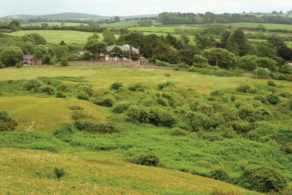
Maes Hiraddug is a delightful spot to visit in spring when wildflowers in this traditional hay meadow come alive with vibrant colour. Owned by the North Wales Wildlife Trust, the grassland has never been ploughed and over 140 different plants have been recorded here.
You can also visit the National Trust’s Graig Fawr, a limestone hill overlooking the Vale of Clwyd. The walk starts near the 21-metre high Dyserth Waterfall.

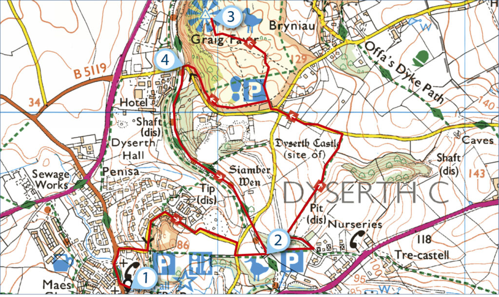
1. START
Exit the Dyserth Falls Car Park by walking out to the road. Turn right and, after passing the church, take a lane on the right uphill to a junction. Cross to a kissing gate and walk across Maes Hiraddug’s meadow to an information board. In early spring, look for blooming cowslips and primroses, while bird’s foot trefoil, twayblade, early purple orchid and common spotted orchid follow as spring turns to summer.
On sunny days, linger to spot comma, meadow brown, orange-tip, small tortoiseshell, painted lady, common blue and speckled wood butterflies.
2. 0.5 MILES
Go through the nearby kissing gate and cross a bridge over a former railway line. Pass through a similar gate and keep ahead uphill, passing through a gate. Emerge on a track, turn left and, before a field gate, veer right into a field.
Walk uphill, with views of Moel Hiraddug’s hillfort on the right, to a stile and lane.
Turn left, pass a lane on the left and cross another lane to a National Trust car park.
Go through the kissing gate and walk uphill to the trig point. Graig Fawr is a Site of Special Scientific Interest known for its limestone plants. Rockrose and wild thyme grow here. Look to the north and you’ll see Prestatyn Hillside, start of the Offa’s Dyke Path. To the south lies forested Mynydd y Cwm, while to the east is Gop Hill with its prehistoric cairn.
3. 1.6 MILES
Return in the direction of the National Trust car park but don’t go through the kissing gate. Have the lane on your left as you follow a clear path downhill, soon taking you through trees. Descend a few steps to emerge on the former Prestatyn-Dyserth Railway Line. If you’d like to visit Y Shed for refreshments, turn right for 500 metres. The railway line operated between 1869 and 1973 to transport quarried stone and coal from the nearby mines.
4. 2.2 MILES
Bear left, passing above the lane and, after another lane, you’ll reach the bridge you crossed earlier. Take the steps on the left to re-enter the nature reserve and retrace your steps to the car park.
USEFUL INFO
Starting point
The car park by Dyserth Waterfall (LL18 6ET). To reach the start, you can catch bus no 35 from Prestatyn or no 36 from Rhyl.
Terrain
Lanes, grassland, woods and former rail track. Gradual climb to 153 metres.
Map
OS Explorer 264
Eat/drink
Caffi @ Y Shed, Meliden (yshed.org), or The Red Lion, Dyserth (01745 570404).
Stay
Abbey Farm Caravan and Camping Park has pitches for tents and motorhomes. abbeyfarmrhuddlan.co.uk