South Pembrokeshire
From the peaceful, tree-banked waterways of the Cleddau Estuary to the spectacular sea stacks, castles and villages of the coast, south Pembrokeshire is the perfect place to while away a spring or summer holiday, promises Julie Brominicks
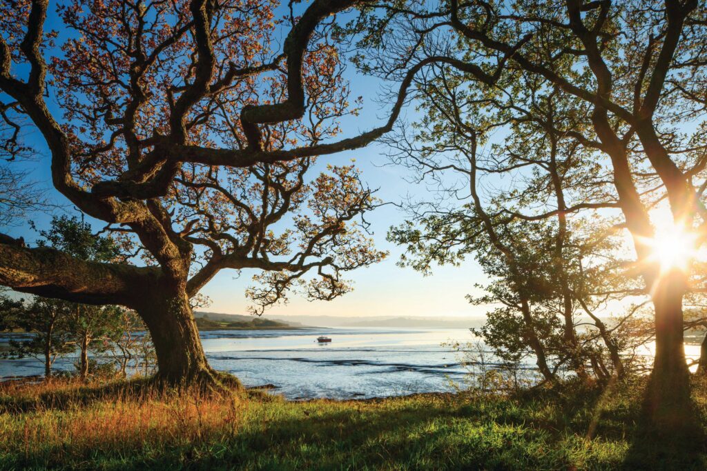
I know I’m in Wales but my brain won’t compute. Scotland it suggests, maybe Brittany? Trying to process the shimmer, the tidal whoosh, the lattice of twisted branches, it refers to memory – perhaps ancient memory.
Irrigated by an oceanic climate, oak woodland similar to this once dominated the Atlantic fringe of Europe, from Scotland to Portugal. The gale-stunted sessile oaks belie their age. Light, too, deceives. Bouncing off the Cleddau, it shifts through the trees.
And the water sounds strange to my ears – neither river-gurgle nor wave-play, this is estuary music. The steadily increasing ‘whoosh’ crept up on me even as the sound of oars in rowlocks and the chatter of friends who rowed me to Lawrenny, dissolves. At the Garron Pill’s confluence with the Daugleddau Estuary, I hear the ‘wheeep’ of a sandpiper and the tremulous warbling of curlews. This soundscape – and its indication of a landscape less disturbed – is precious.
WHAT IS THE CLEDDAU?
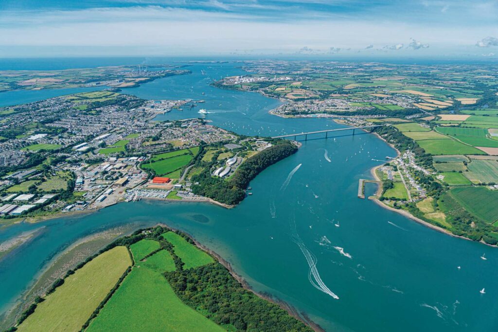
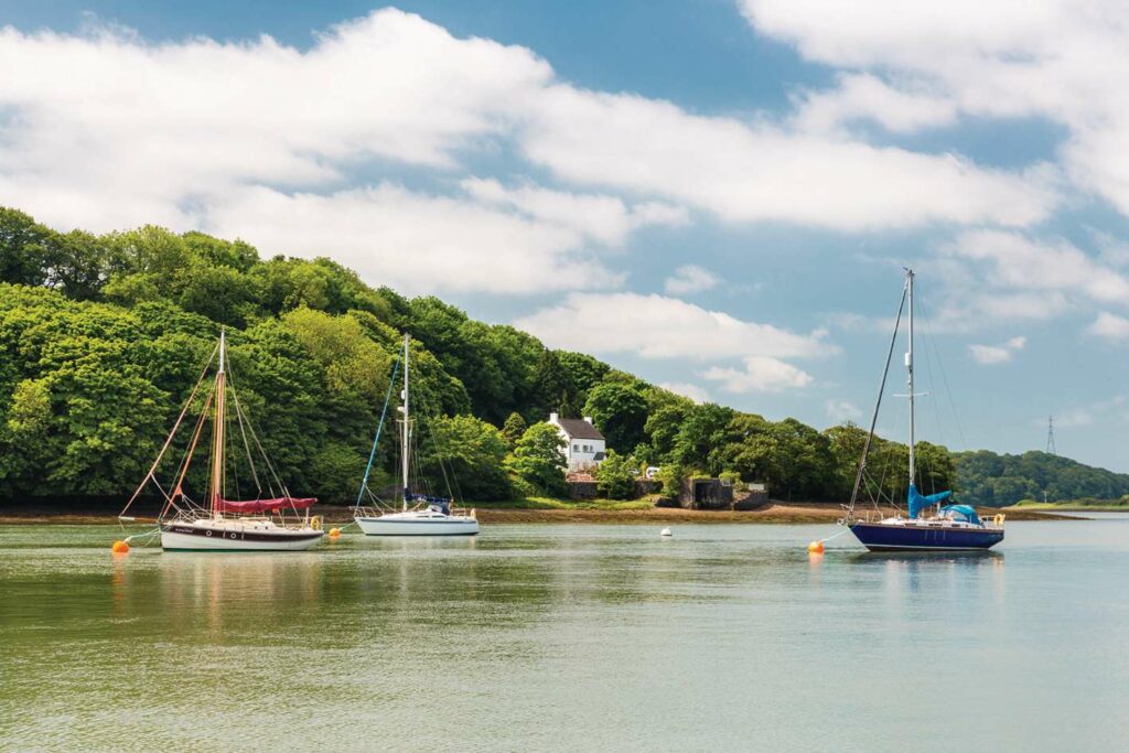
Milford Haven Waterway is 16 miles long between Angle and Neyland, its deep waters concealing cliffs and diverse sponge communities. Intertidal and subtidal eelgrass beds and quiet muddy bays are found in the busy shipping channel (left).
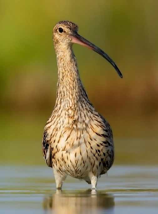
The mood changes north of Cleddau Bridge, known as the Daugleddau Estuary. Here you find quiet rivers that supply the Waterway; the Western Cleddau, the Eastern Cleddau, the Cresswell and the Carew stretch a further 10 miles inland. Here are saltmarsh and tidal creeks. Pockets of ancient woodland survive on the banks. Sinuous streams. Scrub, marsh, rock and estuarine muds support worms and molluscs, wintering waders and wildfowl, sea, brook and river lamprey and plants such as yellow-wort, blue fleabane and wild basil. The rivers were once exploited for herring and shellfish; now they are protected somewhat by legislation and a paucity of roads.
LAND AND SEA
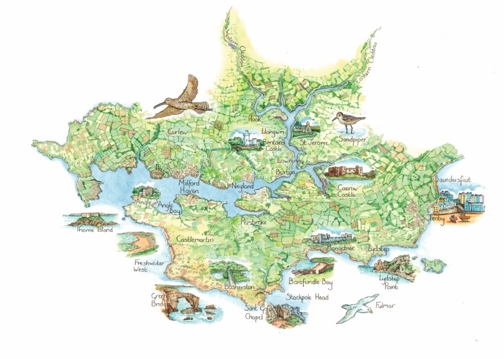
Pembrokeshire is a broad maritime peninsula in south-west Wales split by the Milford Haven Waterway. While Pembrokeshire’s geologically diverse north is dominated by the Preseli Hills, the south is underpinned mostly by bands of old red sandstone and carboniferous limestone that outcrop at the coast and support rolling pastures speckled with cows and sheep.
During the 11th and 12th centuries, this southern area was conquered by Normans, who left behind churches and castles. The ‘Landsker Line’ is a term for the imaginary border, which, prior to language reintroduction initiatives, separated the predominantly Welsh-speaking north from the Anglo-Norman south.
It is this history, and the way the land and sea meet in endlessly fascinating and beautiful ways, that makes Pembrokeshire a delight to explore. The secretive sinuous Cleddau rivers that supply the waterway swell with a tide that ebbs to expose calorific mud banks where birds roam.
To their south is a wave-sculpted coast and between the two an agricultural plateau criss-crossed by narrow lanes on which, in winter, very little traffic passes. It is different in summer when thousands make for the craggy coast with its glorious beaches. Yet beneath the sunny tourism is a feeling of something quieter. Of ebb and flow and insistent but gradual change.
QUIET CLEDDAU
“They couldn’t believe what I said about moles. For jerkins, trousers, you know,” an elderly man is reminiscing over Sunday lunch at The Cottage Inn. “I didn’t trap moles, only rabbits,” replies his companion.
“We would wrap them in brown paper and sell them on Aberdare station.”
A young family on a neighbouring table are enthusing about Biscoff desserts, and neither conversation seems out of place in Llangwm, a small village on the eastern bank of the river estuary.
Traditional jobs may have been lost with the decline of the herring fishing and the shellfish industry, but with few holiday lets, this remains a real community. Llangwm cockle women no longer throw stones at strangers (this legend probably had roots in the cholera outbreak) though locals did object (with somewhat less ferocity) to visitors during Covid lockdowns.
I have walked around wooded headlands and from the path admired Benton Castle, limewashed as it would have been in Norman times. I have heard shouts from a rugby game and visited the Norman Church of St Jerome. The pills and rivers are particularly bewitching. Lapwings and dunlin flock, and delicate redshanks pick their way across the mud.
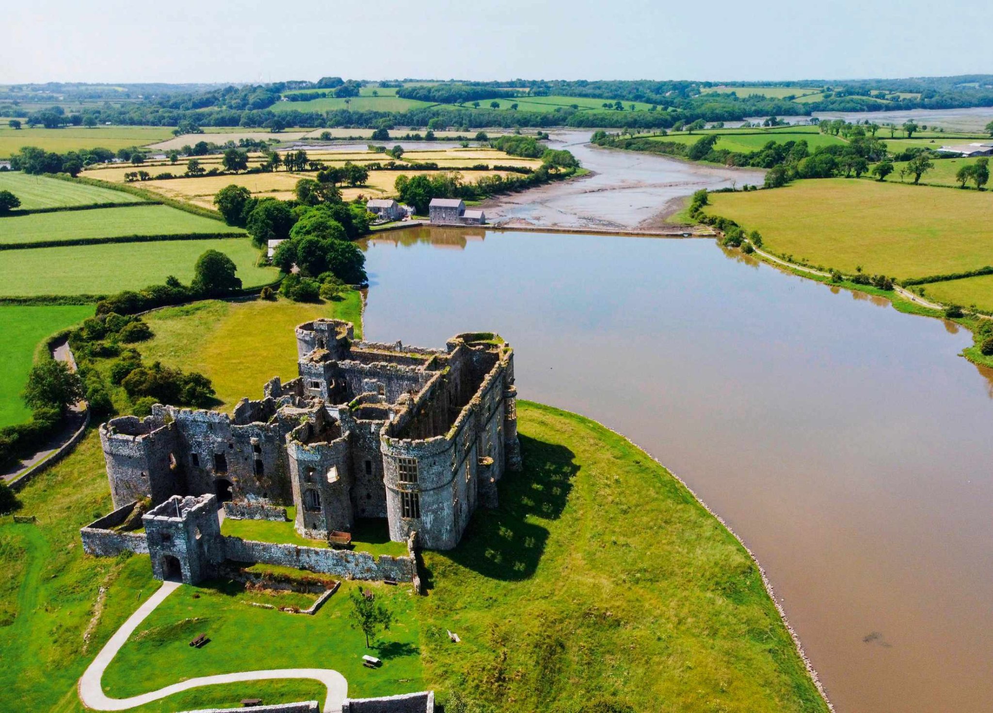
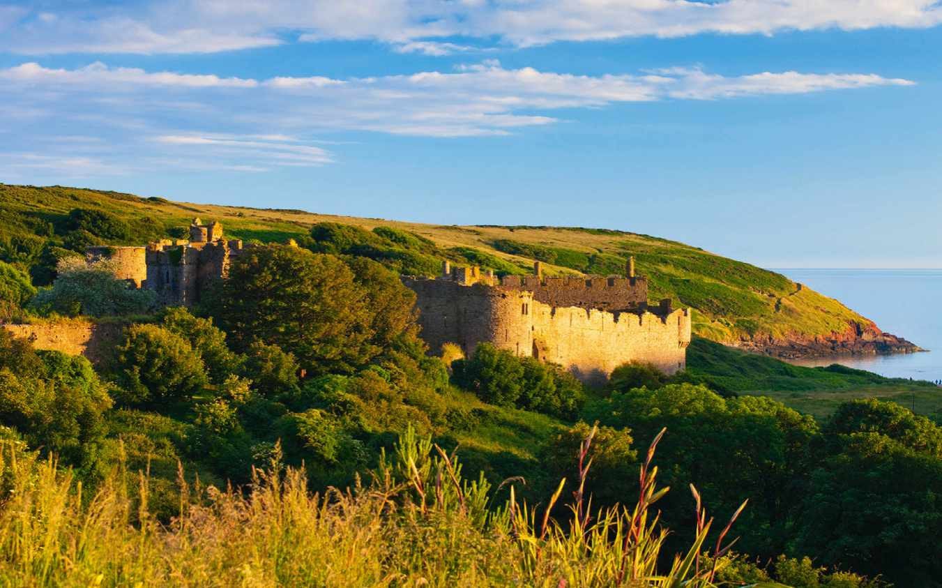
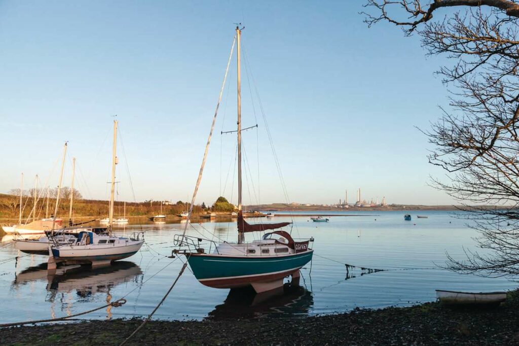
Other settlements in the Cleddau include Burton, Hook and Lawrenny, while popular attractions include extraordinary Carew Castle. Walkers appreciate the long-distance Landsker Trail and miles of wellmaintained footpaths granting access to estuarine creeks and bird hotspots, such as Sprinkle Pill. Those of an active disposition can hire boats from Paddle West in Neyland. It takes a bit of effort to holiday in the remote Cleddau hinterland where there are fewer facilities than on the coast. But this is precisely its charm.
RIVER MEETS COAST
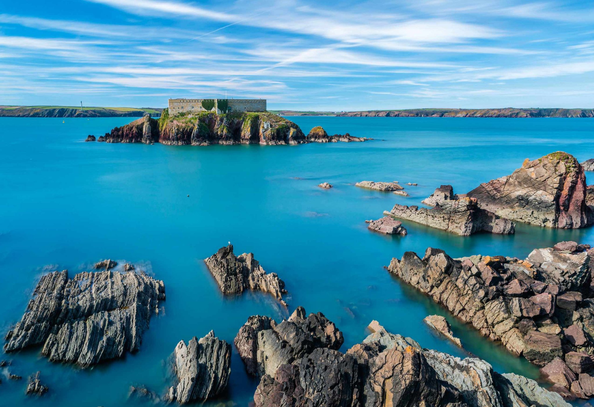
Follow the southern side of the Milford Haven Waterway downstream and you will meet the Angle Peninsula, where coast and estuary unite. Castellated fortifications such as the one on Thorn Island were built along the waterway during the Napoleonic Wars, a precursor of the MOD land now on the point.
Angle Village overlooks a wide swampy bay where, at low tide, exposed mud emits a stirring saline aroma. It is a fine place from which to watch boats – rowing boats, Irish ferries, cruise ships and tugs, and oil tankers bound for refineries on either side of the Waterway. Meanwhile, on the headland, cables are being laid for an offshore wind development.
The Old Point House Inn is home now to seaweed specialists Cafe Môr. “We forage all our seaweed,” Charlie the chef tells me. “But when Danny, who we get our crabs from, was pulling up his pots, he noticed weed growing on the lines, so we’re looking into growing it as well.”
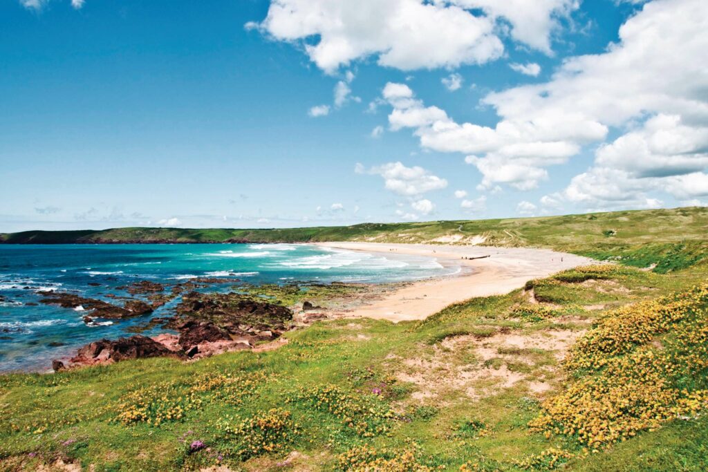
Cafe Môr was established on the south side of the peninsula at Freshwater West, which you can reach on foot quickly through woodland or slowly by coast path, according to one Angle resident. “I’ve only done it once,” he tells me. “It got further away the closer I got. I only had a packet of polo mints. By the end I was breaking them in half – I’ve seen the survival programmes!”
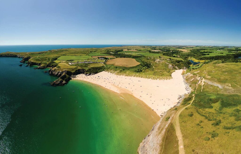
No doubt the eight-mile coast-path walk was worth the effort. Loved by surfers, Freshwater West is a magnificent beach of enormous proportions pounded incessantly by powerful swell.
SECRET SHORES
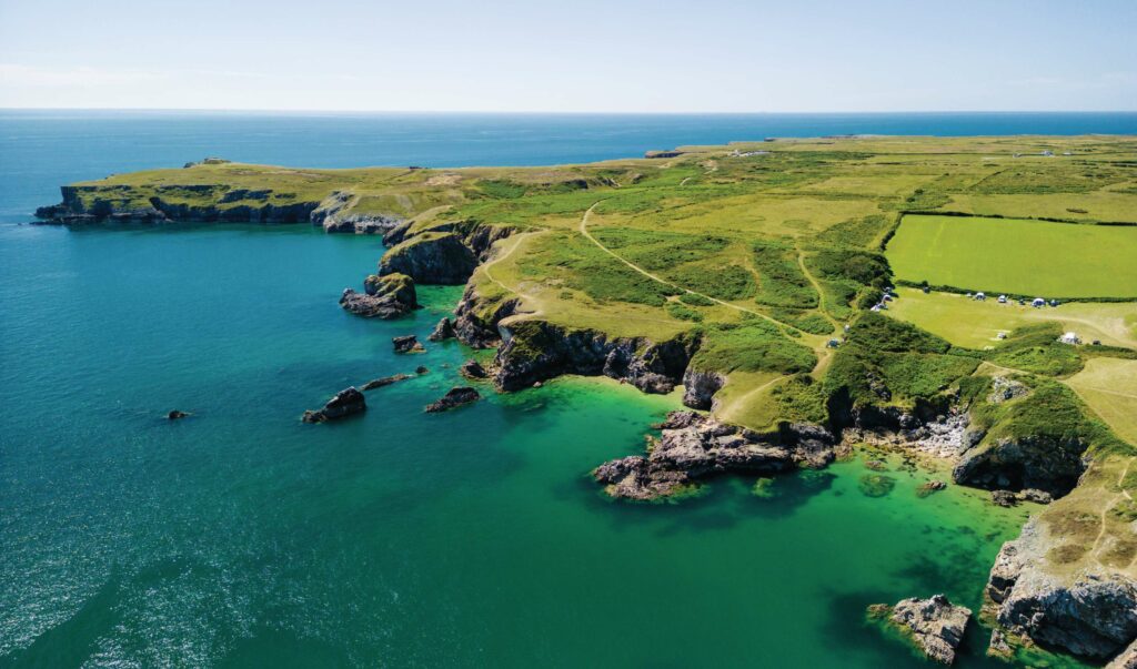
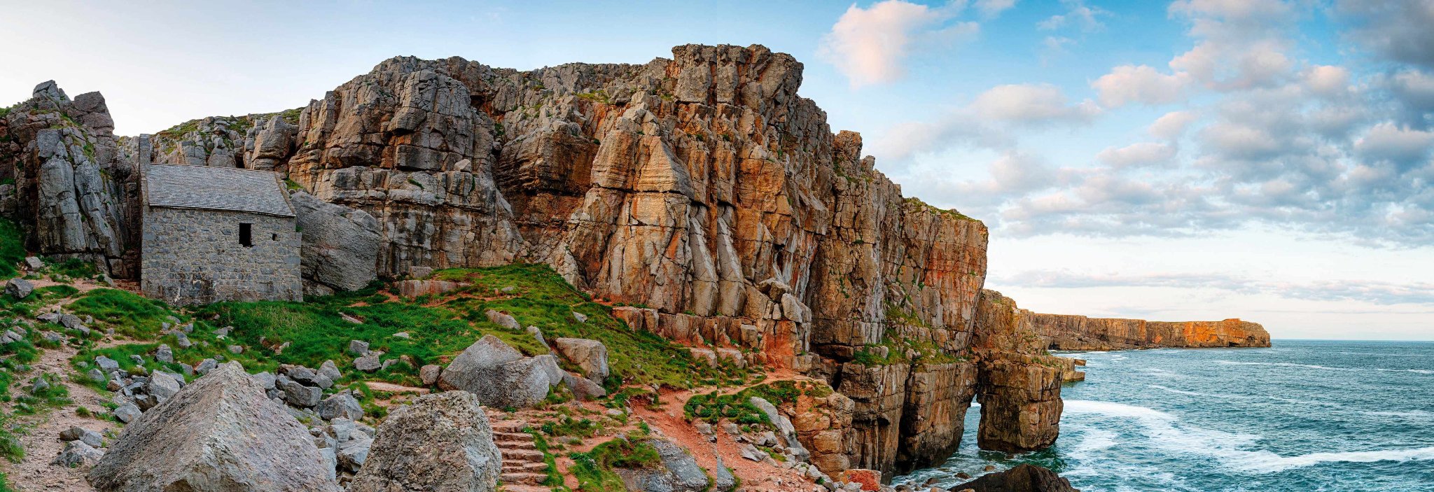
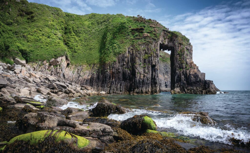
“They’re firing. You’d think we’d get used to it, but we never do,” a woman in Bosherston, 15 miles east along the coast, tells me as a dull boom rumbles. Castlemartin is one of NATO’s largest army training and firing ranges. Whatever your views on the military, the crump of artillery and night-time flashes are part of the scene. Plumped among several extraordinarily beautiful and busy locations, the firing range coexists somehow with visitors to Barafundle Bay, Broadhaven South, Stackpole and Bosherston Lily Ponds. Access is often restricted to the limestone coastal rock formations of Green Bridge, and to St Govan’s Chapel, which, wave-smashed and wonderful, is wedged into the cliff face itself.
A MOMENT IN MANORBIER
Beyond the clifftop village of Freshwater East is another coastal community, Manorbier. The romantic castle and charming church on the headland are further reminders of Norman colonisation. Medieval chronicler, Gerald of Wales was born here. His 12thcentury description of Manorbier still resonates. “On the right hand of the promontory, between the castle and the church, near the site of a very large lake and mill, a rivulet of never-failing water flows through a valley, rendered sandy by the violence of the winds.”
Yet even he was writing some four millennia after Neolithic peoples constructed the capstone tomb at the bay’s entrance.
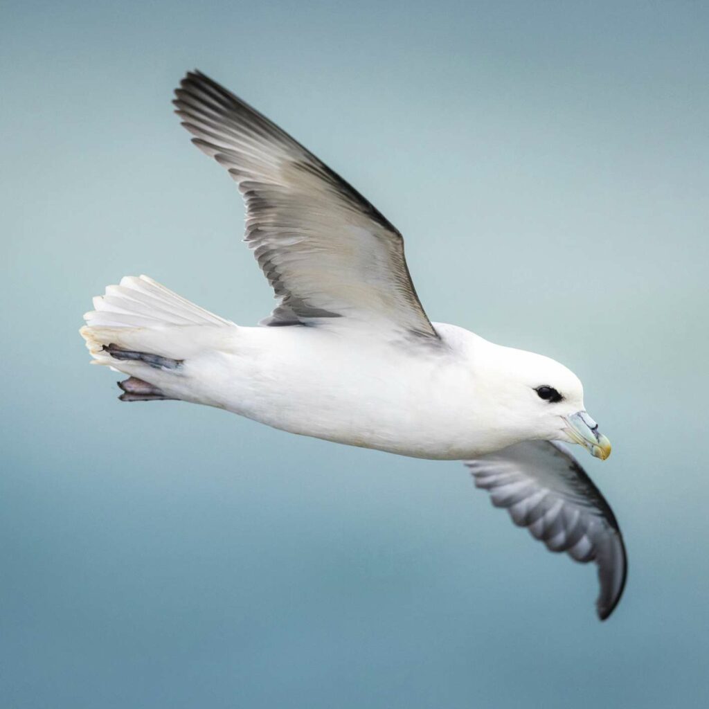
Around the corner, fulmars are roosting on the red cliffs of Lydstep Point. Now and again, one tilts and glides from the ledge, writing circles in the air in precise hypnotic flight. The cliffs, too, are mesmerising. Sunlight enhances their strata and brings out the sandstone’s rubescent tones. The Church Doors – rock walls jutting into the bay, are particularly striking when seen from the coast path.
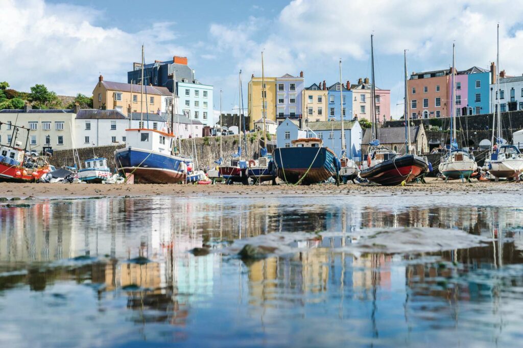
HARBOUR TOWN
A stone’s throw from Lydstep Point is perhaps south Pembrokeshire’s most notable town, Tenby. At times, when the streets are choked, the beaches packed and the taverns loud with drinkers, it can feel that Tenby is full. Not surprisingly, this fortified port town is lovely. The prosperity bestowed on it by Harri Tudur, in thanks for his safekeeping here as a baby, lingers still. There are fewer crowds in half-dark. At dusk, when St Mary’s bells ring out like coins over stony streets. Before dawn by the sailor’s chapel, when the blackbird in the palm tree sings. When moonlit waves cream over black sea. The stone quays look good in lamplight. Can you imagine the banter of fishermen? The craft are mostly pleasure boats now, save for a little mackerel caught in summer. What fishing that remains is largely up the coast in Saundersfoot.
“A few go out for whelks and lobster,” a boatman in a hoody tells me. “Just inshore then?” I ask. “For now,” he says.
South Pembrokeshire is a land of field and coast and estuarine ebb and flow, and it is old, as witnessed by a density of Neolithic monuments. Even since the Norman incursion, customs and industries have come, gone and returned. It is not difficult to imagine renewables replacing fossil fuels one day, and Welsh being spoken more widely. Perhaps the shellfisheries will regenerate and a flourishing seaweed industry will develop. What is certain is that this enchanting land of shimmer and shift, salt and freshwater, woodland and rock, is always in flux.
Julie Brominicks is the author of the travelogue The Edge of Cymru, which celebrates the language, landscapes, peoples and biodiversity of Cymru past and present.
Julie lives with her husband Rob off-grid in Eryri.
WELSH PLACE NAMES
If you don’t speak Welsh, get to know the Welsh names of these featured locations.
Aberllydan De Broadhaven South
Bae Barafundle Barafundle Bay
Bae Gorllewin Angle West Angle Bay
Cei Cresswell Cresswell Quay
Cymru Wales
Dinbych-y-pysgod Tenby
Doc Penfro Pembroke Dock
Dyfrffordd Aberdaugleddau Milford Haven Waterway
Hwlffordd Haverfordwest
Llynnoedd Bosherston Bosherston Lily Ponds
Mynyddoedd y Preseli Preseli Hills
Penfro Pembroke
Sir Benfro Pembrokeshire
Stagbwll Stackpole
Maenorbŷr Manorbier
NOW GO TO SOUTH PEMBROKESHIRE
Where to stay, visit, eat and drink by Julie Brominicks
TRANSPORT
Public transport is very helpful in summer when the narrow lanes are congested with tourists, making passage for tractors difficult. There are railway stations at Pembroke, Pembroke Dock, Tenby and Haverfordwest with smaller request stops en route. These larger towns are hubs for buses to smaller settlements and for the excellent Coastal Cruiser shuttle bus which serves the coast in summer. pembrokeshire.gov.uk/bus-routes-and-timetables
WHERE TO BASE YOURSELF
Lawrenny
On a wooded Cleddau headland, Lawrenny is perfect for a peaceful retreat, with a pub, an independent hostel and space for a few touring caravans at the caravan park.
Angle
Good for boat-watching, Angle is sheltered just inside Milford Haven Waterway and within walking distance of the vast breezy beach at Freshwater West.
Tenby
Although teeming with tourists, this extraordinary bijou Tudor town on its rocky outcrop offers a wealth of accommodation and multiple places to eat and drink.
BEACHES
Skrinkle Haven
Linked at low tide to the extraordinary ‘Church Doors’ rock formation, this is accessible only by steep steps, but looks equally splendid from the clifftops.
Broad Haven South
The drifts of white undulating dunes are embraced by rocky promontories and guarded by Church Rock out in the middle of the bay.
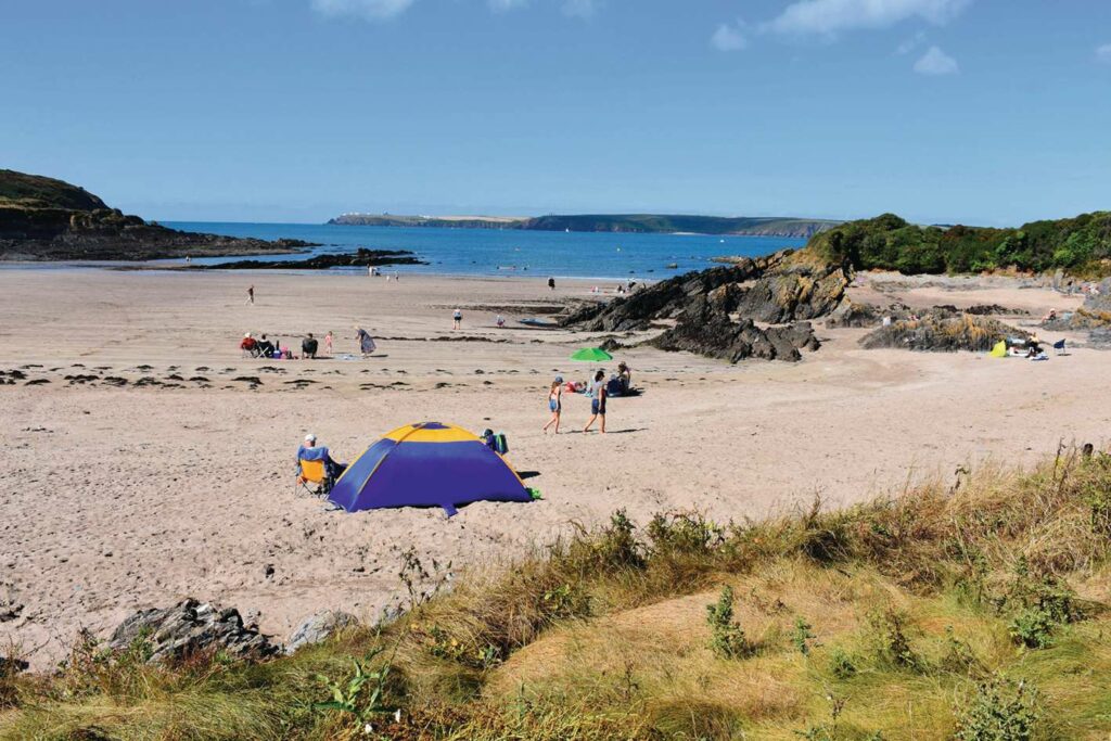
West Angle Bay
Unlike larger and muddier Angle Bay, being only just inside Milford Haven Waterway, this cove is sandy, with rock pools where you may seek the rare cushion starfish.
CAMPSITES
Meadow Farm Campsite, Tenby
Overlooking the harbour with wildflower meadows, greywater harvesting and easy access to the coast path, this is a great site for visiting the Tudor town’s charm cheaply. meadowfarmtenby.co.uk
Cresswell Farm Barn Campsite
Enjoy the company of horses, heifers, sheep and hens at this family-run farm campsite at Creswell Quay in a tranquil inland wooded environment, with meadows, stream and a farm shop. cresswellbarnfarm.co.uk
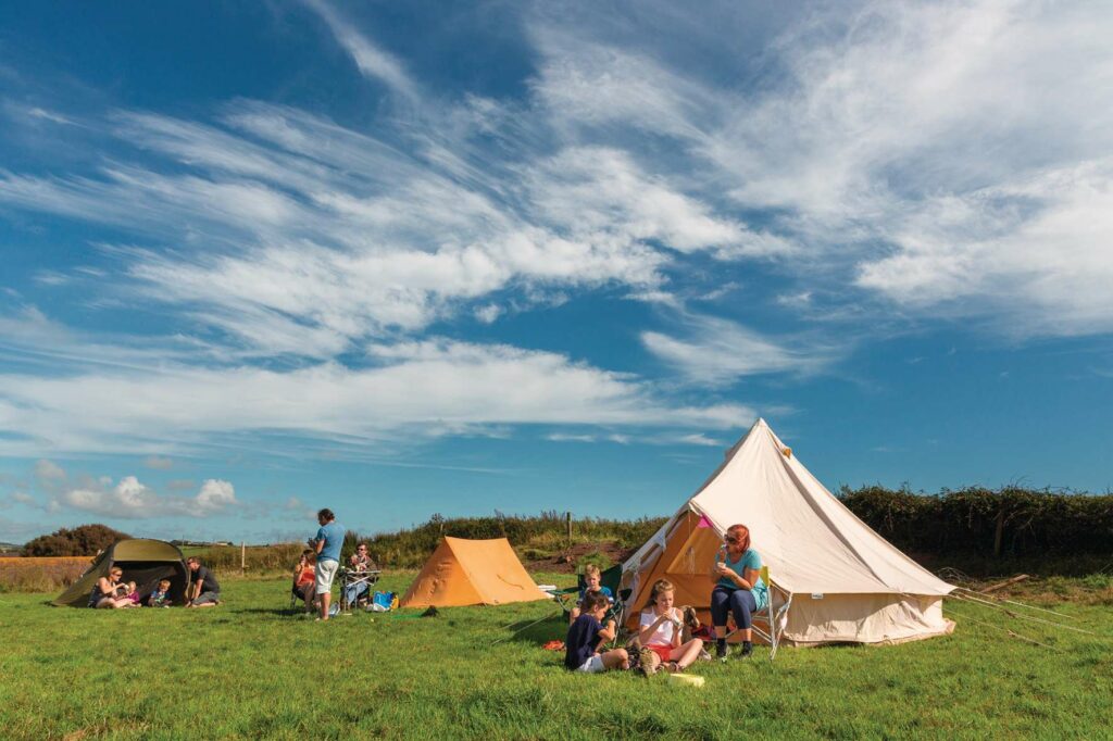
Gupton Farm Camping, Freshwater West
Set in a great location, this National Trust campsite offers a discount for those arriving by bus, bike or on foot. nationaltrust.org.uk/gupton-farm-campsite
FOOD AND DRINK
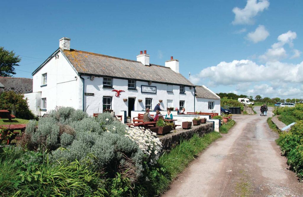
The Old Point House
This pub has been reinvigorated by seaweed specialists Cafe Môr. Expect local shellfish, home-grown veg and homemade delicacies such as dulse tagliatelle with laver pesto. theoldpointhouse.wales
Cresselly Arms, Cresswell Quay
Overlooking the creek, this historic pub is delightfully unmodernised. Arrive by boat on high water, and drift back with the tide after a pint. pubheritage.camra.org.uk/pubs/9096
Fecci’s Fish and Chips, Tenby
Legend has it that in 1935, America-bound Guiseppe Fecci fell so in love with Tenby that he stayed. The Fecci family still serve local fish and potatoes, and homemade rissoles. visitpembrokeshire.com/attraction-listing/feccis-fish-and-chip-restaurant
COTTAGES
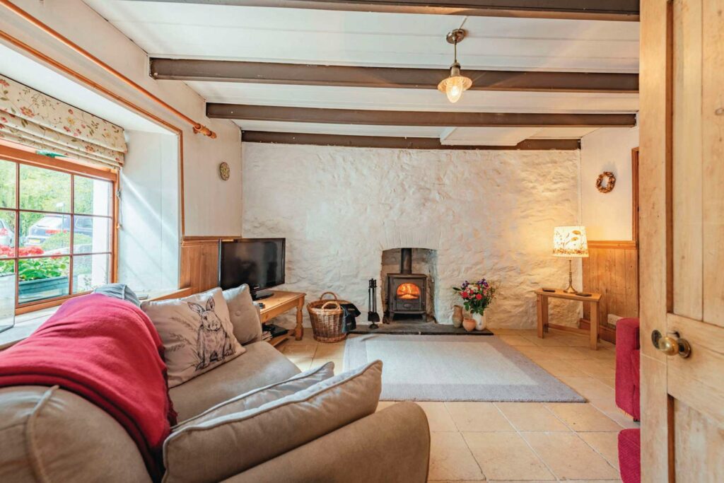
Bridge House, Llangwm
Set by a stream with large garden and balcony, this is a good location for a quiet village retreat. Great both for walking and watching Cleddau wildlife. holidaycottages.co.uk/cottage/81277-bridge-house
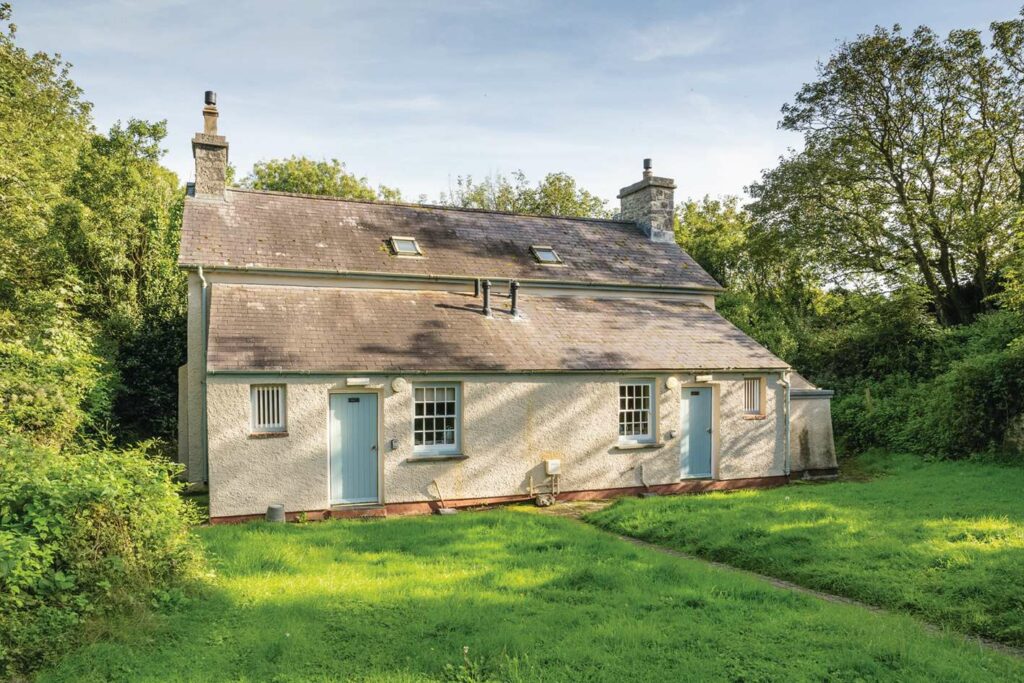
Stackpole Cottage, Stackpole
One of several National Trust properties on the Stackpole Estate, this is well situated for Stackpole, Broad Haven, Bosherton Lily Ponds and Barafundle Bay. nationaltrust.org.uk/holidays/wales/stackpole-cottage
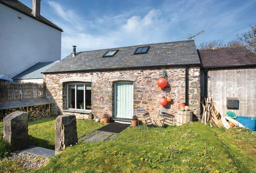
Bangeston Barn, Angle
With solar water heating and a wood-pellet boiler, this limewashed converted barn sleeps six and includes a charming crog loft. Pet-friendly and only 750m from East Angle Bay. coastalcottages.co.uk/cottages