YORKSHIRE AND THE HUMBER
13. NORTH YORKSHIRE, ROSEDALE RAILWAY
Distance: 7.9 miles/12.7km | Time: 5-6 hours | Grade: Moderate | Total ascent: 162m
For more walks and days out visit countryfile.com


Heather-clad moors, industrial heritage and, on a clear day, panoramic views of Rosedale: this is the Rosedale Mineral Trail.
Steeped in history, the Rosedale Mineral Trail is an easy-access, there and-back route that follows the old railway line that served Rosedale’s 19th-century ironstone mines. From the 1850s, the ironstone in Rosedale’s hills was so valuable that a 20-mile standard gauge railway was built to transport this mineral wealth to County Durham.
These days, the railway is no more and nature has reclaimed the landscape. In late July and August, the moors are a vast swathe of purple heather. From May to September, look out for the speckled gold and black breeding plumage of golden plovers. Rosedale contains some of the best upland hay meadows in the North York Moors. Wild daffodils are also found throughout the valley, providing a cheerful spring welcome.
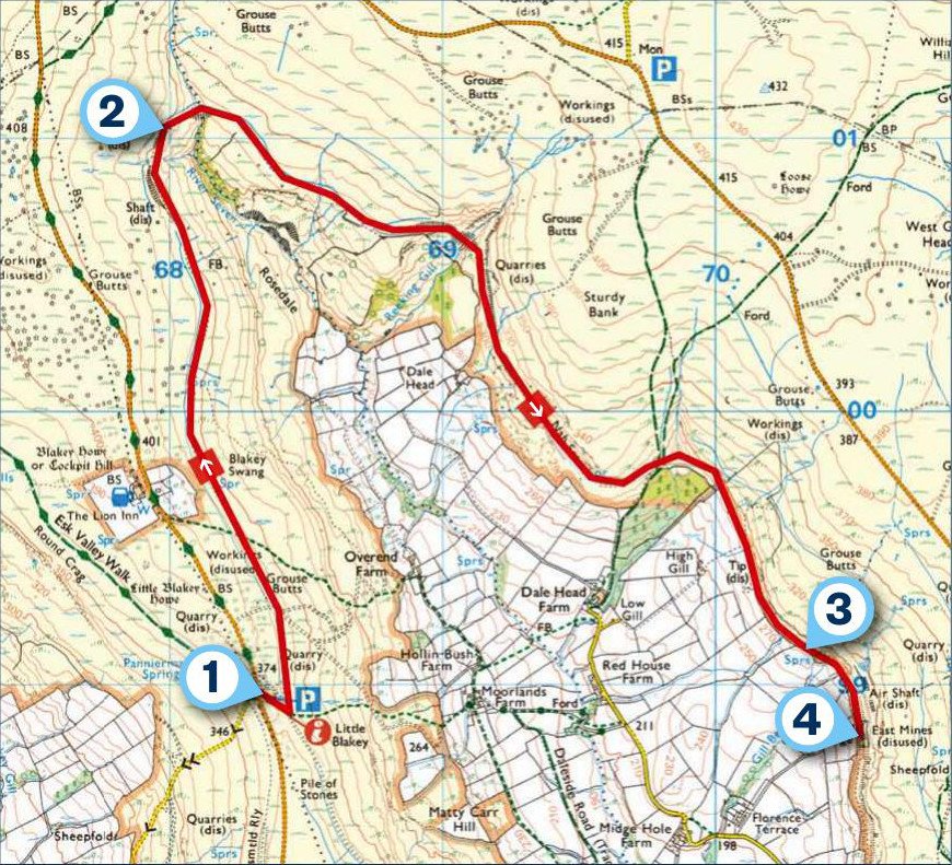
1. START
The walk begins at the Little Blakey car park and a short track leads down to the horseshoe track that curves around the valley. The track follows Blakey Swang, where one wall of the ruined water tower stands proud. It is hard to imagine that at one time the water tower was used to top up the steam engines, as they chugged up the incline to Blakey Junction.
2. 1.5 MILES
Continue along the track where it now cuts through the railway embankment and on to the head of the dale. This is a great place to pause to simply absorb the view. Manual wheelchair users may wish to turn around at this point.
The track along the east side of the dale has a few steeper sections, but nothing too challenging for a powered all-terrain mobility wheelchair/ scooter. The track passes through more railway cuttings and over Reeking Gill, before it continues along Nab Scar.

3. 3.7 MILES
Soon the remains of the Black House cottage, complete with fireplace and chimney, come into view. When the railway closed, the miners and their families left, and rows of miners’ cottages were abandoned.
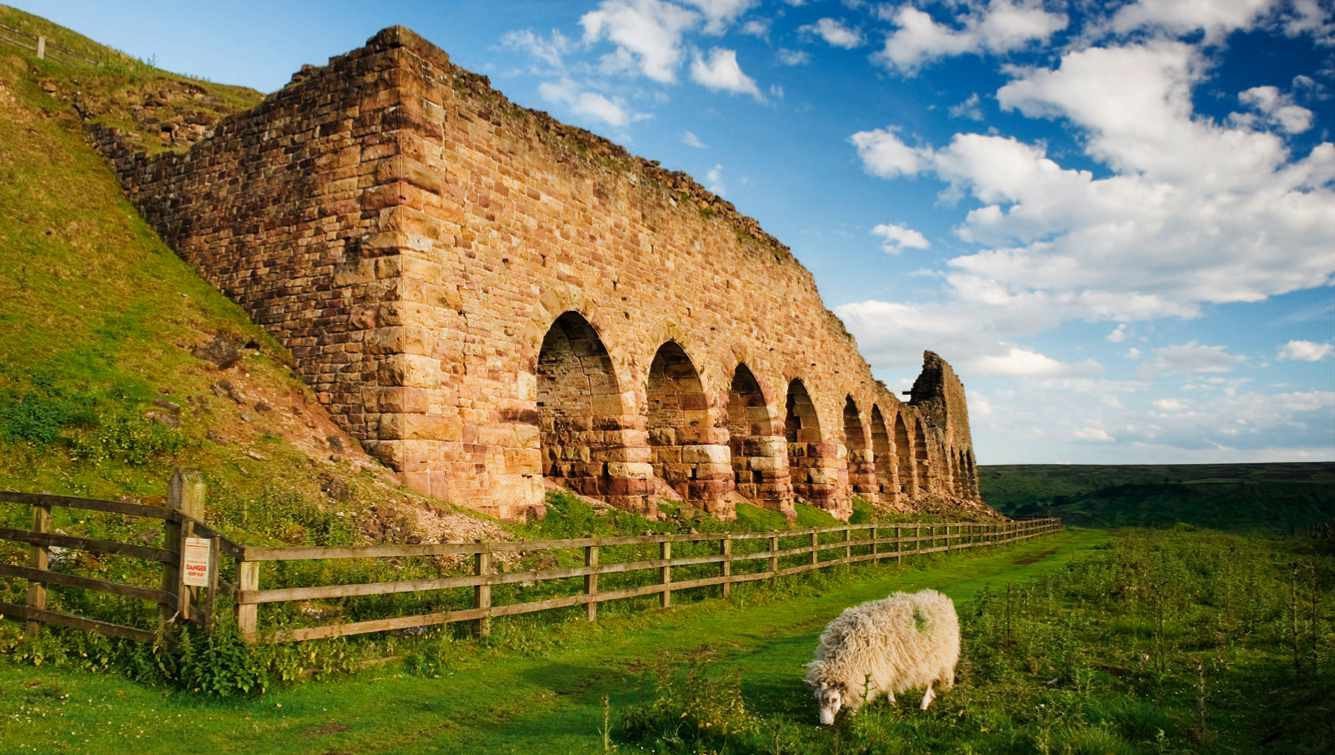
The route now passes by the remains of the old kilns. During the boom years of Rosedale’s ironstone mining, the Iron Kilns were one of three sets where ironstone was calcined (roasted) before being taken to Teesside and further afield for iron and steel production.
4. 3.9 MILES
The turning point on this stile-free trail is at the iconic Stone Kilns. The 16 arches of the old kilns are an impressive sight and the mighty remains of a once-thriving ironstone industry in Rosedale. Information boards by the arches tell you the history of the kilns and the railway.
USEFUL INFO
Starting point
Little Blakey car park, nearest postcode: YO62 7LQ.
Terrain
The path has a hard, compacted surface and is fairly level until reaching Dales Head. From here, there are steeper sections on the east side of the valley, proving challenging for a manual wheelchair user. Powered all-terrain wheelchairs or families with buggies will have no issues. Dogs must be kept on a lead.
Map
OS Explorer OL26
Eat/drink
The Lion Inn, a popular 16th-century freehouse, is located near the start and finish of the walk, at the highest point of the North York Moors. lionblakey.co.uk
Abbey Stores & Tearoom is close by for afternoon tea and cakes. abbeytearooms.business.site
Toilets
The nearest accessible toilets are at Rosedale Abbey. Rosedale Abbey Caravan Park has accessible facilities for disabled people.
In association with
