WALES
08. POWYS, FAN Y BIG
Distance: 10.2 miles/16.4 km | Time: 6-7 hour | Grade: Challenging | Total ascent: 707m
For more walks and days out visit countryfile.com


The Old Red Sandstone peaks of the Brecon Beacons form an impressive backdrop to Llanfrynach village.
Nant Menasgin, a river running through the village, originates from streams beneath two of these peaks, Waun Rydd and Fan y Big.
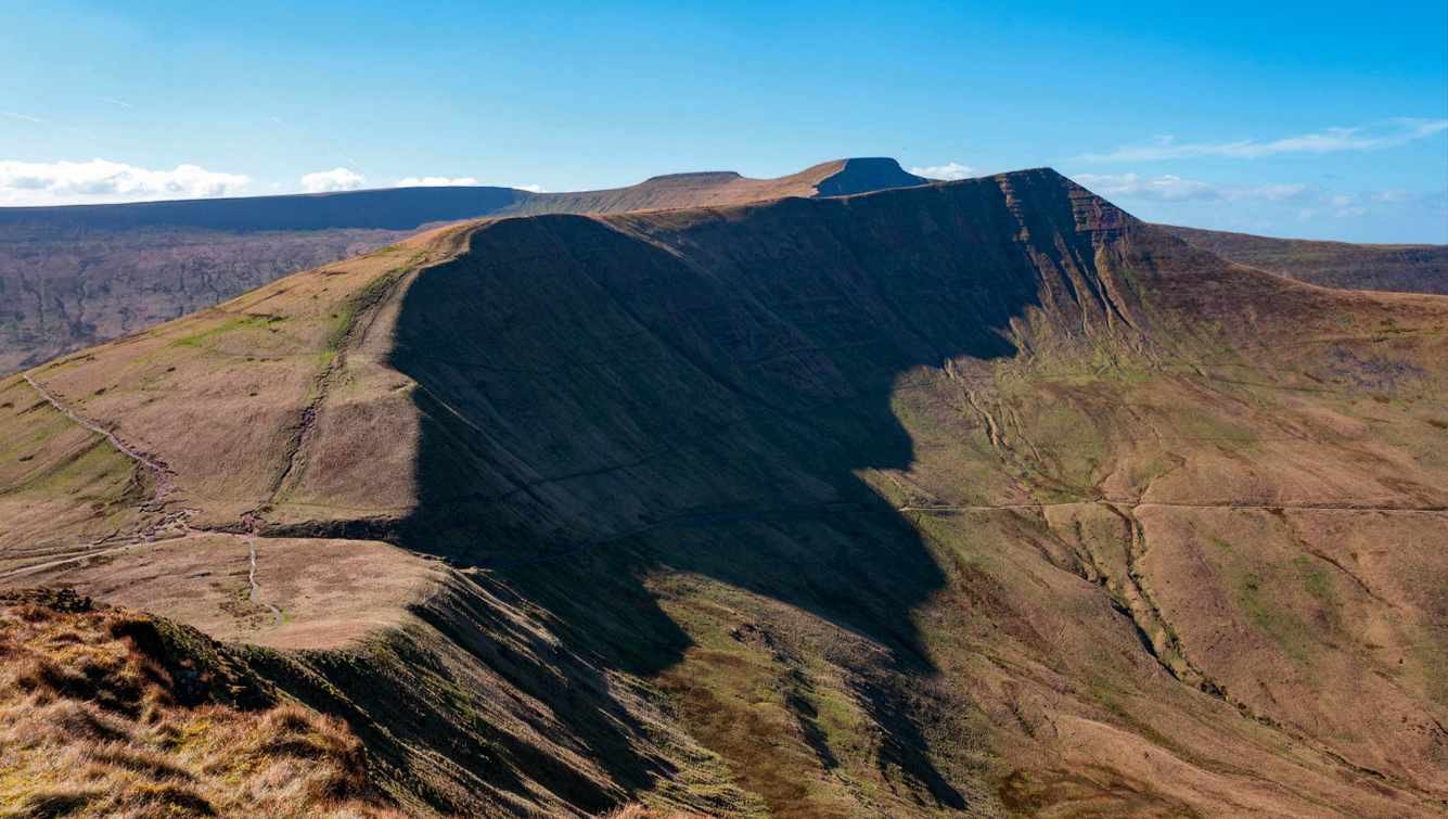
This walk follows the river upstream before climbing the long ridge to Fan y Big, with epic views across the other Beacons, north to the Black Mountains and south to “the Valleys”.
1. START
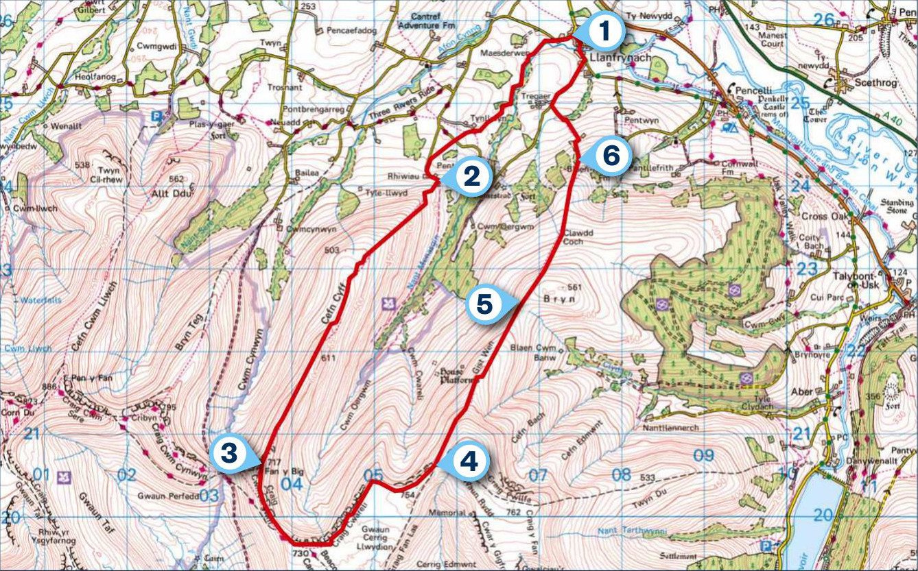
Leave Llanfrynach on the lane adjacent to the village hall. Take the first bridleway on the left. Red kites may be seen coasting currents above the farmland. When the path splits into three, take the bridleway to the top right corner of the field. Cross a lane on to a footpath then turn left at the next lane.
2. 1.8 MILES
At Pen-yr-Heol Barn, take the sunken lane on the right. Here, old walls have been burst apart by the fused roots of beech trees. Moss thrives over stone, hazel and holly in this holloway.
At its end, follow the main path as it curves leftward on to the ridgetop. To the right, the eastern faces of Cribyn and Pen y Fan are lined by crevices that look like wrinkles on these aged pinnacles. Ahead, Fan y Big looks to have been tweaked from the landscape into a point by some cosmic potter. Peat starts to become prominent underfoot.

3. 4.4 MILES
At the peak of Fan y Big, take the left-hand path passing a stone shelter. Reaching another path, take a left. From here there are views to the south, towards Merthyr Tydfil and the Taff Valley beyond. At a large cairn, continue following the ridge, with the drop to your left.
4. 6.5 MILES
At a col before Waun Rydd, ignore paths turning right. On a clear day the church tower at Llanfrynach is visible. As you leave the mountain behind, the view opens up. In front is the ridge of the Black Mountains and the large natural lake of Llangorse, renowned for its pike fishing. To the right, 451m-high Table Mountain and Sugar Loaf, just north-west of Abergavenny, can be seen.
5. 7.8 MILES
At a division of quad bike tracks, go straight ahead. Take a single track leaving the quad tracks and follow it over the shoulder of Bryn. Take the central grass track through a patch of gorse and bracken. Drop steeply to the left corner of the field.
6. 9 MILES
Go through the gate and take the path following the fence through a wood. Turn right and follow the footpath until it meets a concrete track. Turn left, on reaching the lane turn right into Llanfrynach.
USEFUL INFO
Starting point
Llanfrynach is serviced by bus number 43 which runs between Brecon and Abergavenny. There is limited parking on the village roadsides. A public toilet in the village is generously maintained by local volunteers.
Terrain
The route starts crossing farmland but soon becomes mountainous and could be particularly arduous in inclement weather conditions.
Map
OS Explorer OL12
In association with
