WALES
07. Teaeth Ligwy, Anglesey
Distance: 4.4 miles/7km | Time: 3 hours | Grade: Moderate | Total ascent: 152m
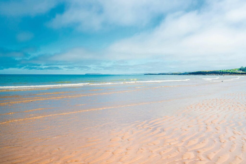
Teaeth Ligwy is a beautifully delightfully spacious, sheltered, unspoilt beach bordered by low sand dunes and cliffs on the north-east coast of Anglesey. Soft sand shelves gently to the sea, offering plenty of room for bathing. The circular walk starts in the pretty former fishing village of Moelfre, where it joins the coastal cliff path, passing memorials to the Hindlea and Royal Charter shipwrecks. The return route takes in Din Lligwy a 4th-century settlement, as well as an impressive Neolithic burial chamber.
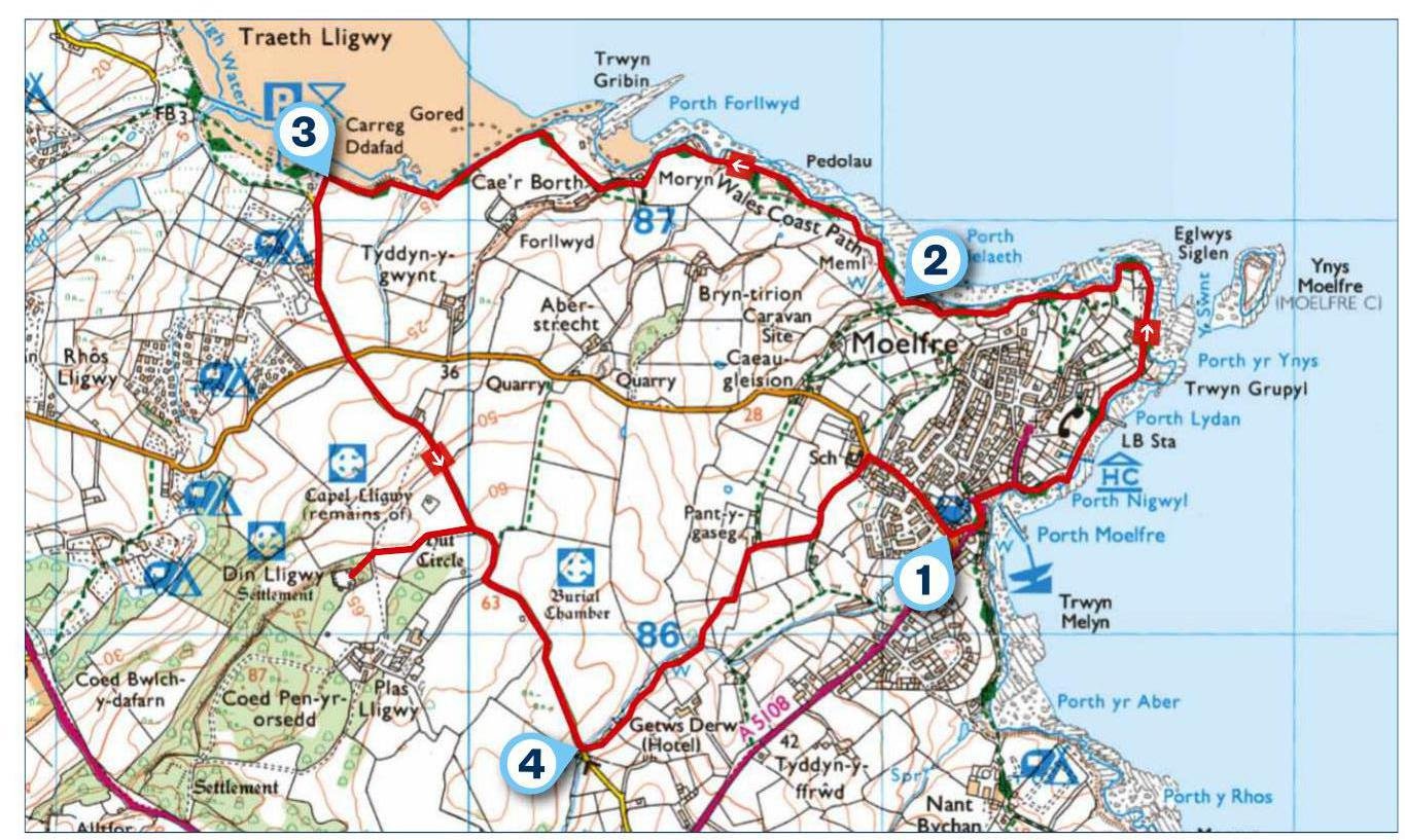
1. START
At the car park, go past the toilet block and cross the road to a path left of the bus shelter. Pass Ann’s Pantry and, at a road, go left above Moelfre’s small beach to walk uphill. At a left bend, bear right along the coast path, passing the Seawatch Centre and sculpture of Dic Evans, coxswain of the Hindlea rescue in 1959. Beyond the lifeboat Hindlea follow a path to the station and a small beach, memorial seat at the end of the headland. Continuing along the coast, you emerge in a caravan park before descending to Porth Helaeth beach.
2. 1 MILE
The path rises, passing a stone stile giving access to the Royal Charter monument. More than 450 people lost their lives when the steamship, returning from Australia with a substantial cargo of gold, sank in a hurricane nearby in 1859. As you continue along the cliffs, look out to sea to watch for porpoises. Further on, the coast path takes a track slightly inland, past houses, before running directly above Traeth Lligwy. The easiest way to get down to the beach for a dip is just before the coast path reaches the car park. The sea comes in quickly, so be aware of the tide times and avoid the sinking sand at the far western end of the beach.
3. 2.1 MILES
From Traeth Lligwy, follow the lane ahead and go over a crossroads. Take a kissing gate on the right for Din Lligwy and walk through fields and a small wood. Here lie the remains of roundhouses and workshops occupied by a local chieftain in the Roman era. Returning to the lane, bear right to find the Neolithic burial chamber on your right and, further on, go through a kissing gate on your left.
4. 3.5 MILES
Follow the right side of the field to a gate in the far corner then continue with a fence on your left. Take the next kissing gate on the left and slant uphill to another one. Go over the hill and, at the field’s left corner, bear left downhill to a kissing gate at buildings. Soon, go right through a gate and along an access track. Pass a school and bear right to return to the starting point.
USEFUL INFO
Starting point
Ffordd Lligwy, Moelfre car park LL72 8HG. Bus no 62 from Bangor and Amlwch.
Terrain
Cliff coastal path, lanes and fields. Some ups and downs.
Map
OS Explorer 263
Swim
Easiest access to Traeth Lligwy is just before the coast path reaches the car park.
Eat/drink
Ann’s Pantry Restaurant and Café at Moelfre. Seasonal café at Traeth Lligwy; 07789 225394
In association with