WALK: Ben Nevis, Highland
Mountain with its head in the clouds
The ‘malicious mountain’, the ‘mountain with its head in the clouds’ – Britain’s highest peak has a number of daunting epithets, but come prepared and you will be rewarded with some of the greatest views in the country, assures Fergal MacErlean
Tune in
Join Mark Stephen, Euan McIlwraith and Helen Needham as they climb Ben Nevis in Scotland Outdoors. Available on BBC Sounds.
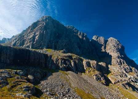
Towering above the west coast town of Fort William in Lochaber is mighty Ben Nevis, a huge whale-back peak that ends dramatically with a formidable band of cliffs. At 1,345m, ‘The Ben’ is Britain’s highest mountain.
The summit of Ben Nevis is composed of andesite, which collapsed, as lavas, into a chamber of molten granite 410 million years ago. This explosive past, and its status as Britain’s highest peak, attract some 125,000 visitors every year. Most come to bag the
Munro via the main 10-mile Mountain Track, or Pony Track, but it is also a magnet for climbers drawn to its many famous winter and summer climbing routes, not least the North East Buttress.
The name Ben Nevis is an anglicisation of the Gaelic ‘Beinn Nibheis’, which has two translations: one meaning the ‘malicious mountain’ or ‘venomous mountain’; the other the ‘mountain with its head in the clouds’. Which translation is most accurate remains open to debate, but Beinn Nibheis certainly has its share of cloudy days, with 355 on average every year.
This is mountain country, and where there are mountains in Scotland, there is often a suitable cast of upland wildlife. Golden and white-tailed eagles may be seen, as well as red deer, pine martens, snow buntings, ptarmigans and, in spring, rare butterflies, such as the chequered skipper.
BEFORE YOU CLIMB…
The path to Ben Nevis starts close to sea level and involves a huge vertical ascent to reach the summit at 1,345m (4,413ft). Initially a good, wide path ascends the lower slopes but this deteriorates on the higher, rough, granite boulder-and-scree-strewn ground below the summit.
Experienced walkers should complete the return route in five to six hours, others may take up to 10 hours. Competency in mountain navigation is essential. During the winter months and into early summer, when snow still covers the upper part of the mountain, you may also need an ice axe and crampons – and know how to use them. Mid to late summer is the best time for an ascent.
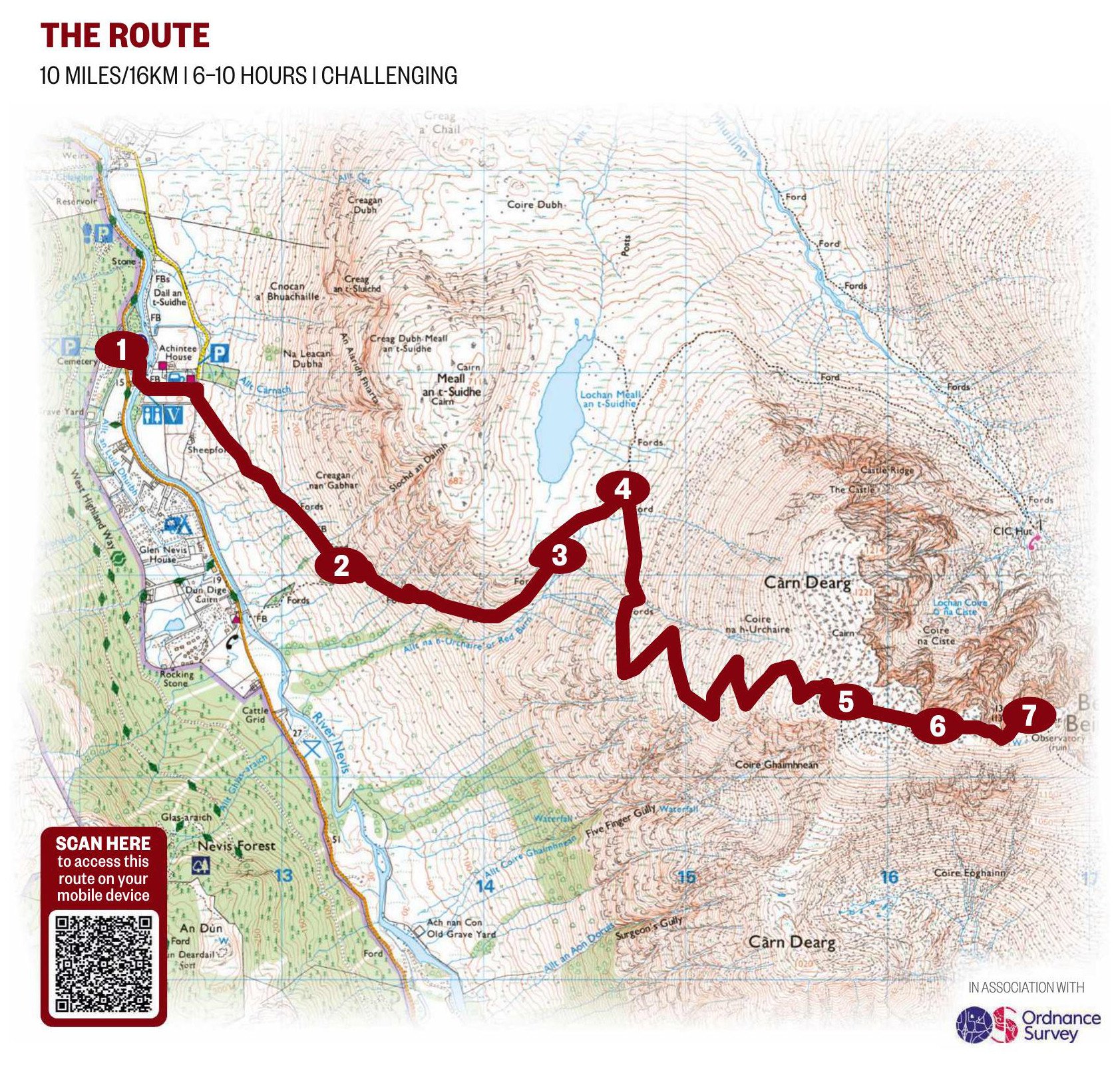
1 OVER THE RIVER
Start from the Ben Nevis Visitor Centre in Glen Nevis where there is a pay and display car park.
Cross the nearest bridge over the River Nevis. Turn right then left, uphill, at a sign. Cross a track to join the path that leads from the nearby Ben Nevis Inn across the flanks of Meall an t-Suidhe.
2 STOB BÁN VIEW
Further on, the path hairpins before climbing steeper and rockier ground. From here, you can see the sharp peak of Stob Bán among the Mamores above Glen Nevis.
3 PAST THE LOCHAN
The path ascends beside the Red Burn, before taking a sharp left turn. Walk on to reach the plateau that holds Loch Meall an t-Suidhe, erroneously called the Half Way Lochan.
4 BIG RIGHT
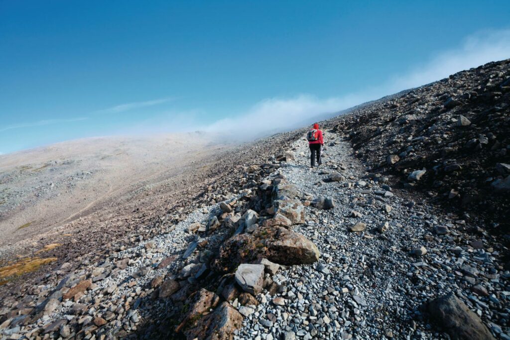
Keep heading north-east to reach a junction and go right. After 500m, you cross a deep gully that holds the Red Burn. Stay on the path (to avoid causing erosion), zig-zagging up increasingly rough ground.
Note that navigation in mist or with snow underfoot will make the ascent much more difficult. Keep track of your position on the map by counting the corners on the zigzags, backed up by GPS or timing and pacing.
5 FIVE FINGER GULLY
Care is needed to stay on the main path. Avoid veering south to the dangerous steep screes at the head of Five Finger Gully. In good conditions, there are excellent views of Glen Nevis below.
6 SUMMIT PLATEAU
Hike on to McLean’s Steep – a notable section of ascent – between 500 and 600 metres west of the top. Now on the summit plateau, beware of perilous drops close to the path on the left at Tower Gully and then at Gardyloo Gully. There is a major change in direction once the latter has been passed – marked by a navigational cairn, the last in a series from Red Burn. Walk on north-east to the summit, where there is a massive cairn, on top of which sits a concrete trig point.
“THE HUGE, WHALE-BACK PEAK OF BEN NEVIS ENDS WITH FORMIDABLE CLIFFS”
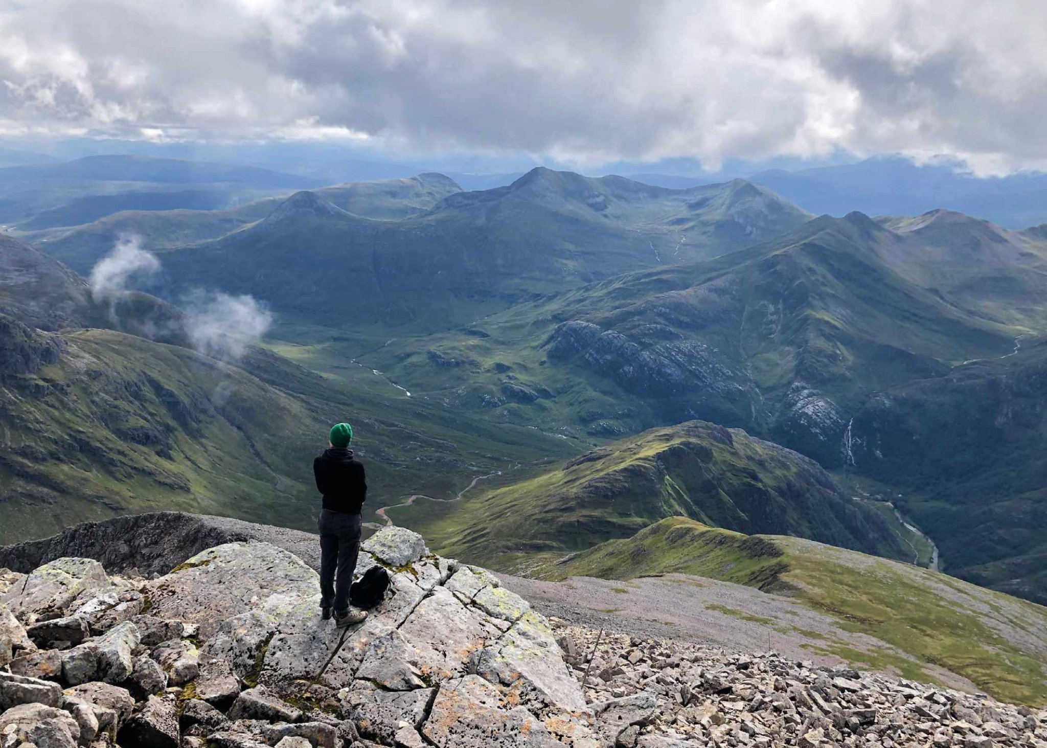
7 MISTY VISTA
The top also holds the remains of an observatory, a shelter and several cairns. Just a few metres to the north, the cliffs drop vertically. In spring and early summer, snow cornices at the cliff edge are likely to be highly unstable, so keep well back.
The panoramic view is one of the grandest in the Highland, with peaks in all directions and Fort William and Loch Linnhe to the west. You eye is likely to be drawn to Ben Nevis’ mesmeric north face, where you may spot rock climbers on Tower Ridge or on other classic climbs.
To retrace your steps, you should always take a compass bearing, as even in good conditions, hill mist can shroud the mountain’s upper slopes in a matter of minutes and it can be difficult to tell if you’re on the main path. From the summit cairn, walk for 150 metres on a bearing of 231°
(subtract magnetic variation), which will take you safely past Gardyloo Gully on your right. Then follow a bearing of 282° (subtract magnetic variation), which will take you down to the zig-zags on the Mountain Track, avoiding Five Finger Gully with its deceivingly gentle upper slopes – sadly, it has been the scene of many accidents.
If the zig-zags are snowcovered, you must be careful to avoid drifting too close to the slopes above the Red Burn, which are avalanche-prone.
From Red Burn, continue on your outbound route back to the car park, taking care to navigate as you go.
THREE MORE WAYS TO EXPERIENCE BEN NEVIS
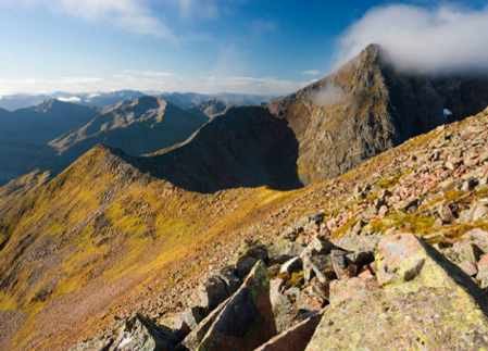
CARN MÓR DEARG ARÊTE For the mountaineer, an ascent of Ben Nevis by the long, slender, Carn Mór Dearg Arête offers an aesthetically satisfying circuit with unrivalled views of the great cliffs, corries and ridges on The Ben. Scrambling skills are called for on this long outing.
THE NORTH FACE Up close, the scale of the 700-metre (2,300 ft) cliffs of the north face is daunting. Many routes are historically important, with first ascents dating from the late 19th century. Winter draws climbers from across Europe to ascend the ice-clad gullies and blocky buttresses.
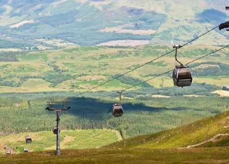
GONDOLA The Nevis Range Scenic Mountain Gondola ascends half way up the Munro Aonach Mór, with a stunning outlook to the west and north. From there, in the snow-free summer months, the 40-minute return walk to Sgurr Finnisg-aig gives superb views of Ben Nevis and Carn Mór Dearg.
NOTE: Climbers and walkers accessing Ben Nevis and Carn Mór Dearg from the north will face disruption until March 2023 due to forestry operations in Leanachan Forest. This does not affect parking or access to the main Mountain Track from Glen Nevis.
How to use OS Maps on your device
OS Maps gives unlimited access to OS maps throughout Great Britain.
Discover hundreds of thousands of ready-made routes at your fingertips.
No signal? No problem. Download maps and routes and use them wherever you go.
Visualise your routes in full 3D, and print out as required.
Use the AR Viewer to pan across the landscape and rediscover your view.
Get access to the whole of Britain for only £28.99 for a 12-month subscription.
Fergal MacErlean is an outdoors writer who loves exploring Scotland on foot.