WEST MIDLANDS
10. SHROPSHIRE, THE LAWLEY
Distance: 3.9 miles/6.3 km | Time: 2.5 hours | Grade: Moderate | Total ascent: 258m
For more walks and days out visit countryfile.com


The Lawley is a sleek and slender hill, the first in the north-east to south-west fault line of eruptions that comprise Shropshire’s Stretton Hills.
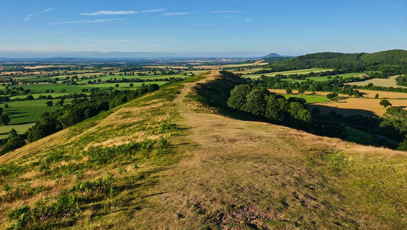
Quieter than its more popular and taller neighbours, Caer Caradoc and the Long Mynd, this 377m peak punches well above its weight when it comes to views. Not only does The Lawley offer glorious glimpses of the Stretton Hills and the Long Mynd, but on a clear evening the vista stretches across the Shropshire Plain towards the Berwyn Mountains in Wales.
1. START
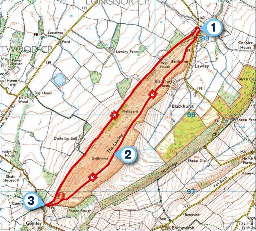
From the small car park, climb to a kissing gate. Ascend through trees, heeding warnings about keeping dogs on leads. You may see livestock not normally associated with Shropshire; look out for Highland cows and Herdwick sheep.
The Lawley teases with four false summits, each offering better views than the previous. Turn round at the first to spot The Wrekin 10 miles away. This volcano-shaped hill is the last peak between here and the Staffordshire Moorlands. A broadband transmitter shares the second false summit, with its better westward views of the Long Mynd and Church Stretton. The ridge path conquers two more false summits, before the final, steeper ascension to The Lawley’s true summit, crowned by a telegraph pole once topped by a weather vane.
2. 1.2 MILES
On sultry summer evenings, paragliders launch themselves off the hillside, hoping to share a thermal with a skylark or buzzard. The summit panorama includes most of Wenlock Edge, a 17-mile wooded escarpment running from Much Wenlock to Craven Arms, and Shropshire’s highest point, the twin-peaked Brown Clee Hill dominating the horizon. Adjacent to that is Titterstone Clee Hill, with its golf-ball-shaped air traffic control radar domes.

Sweeping southwards, the rolling hulk of Hope Bowdler Hill fills the landscape, along with the iconic Caer Caradoc. Its lesser-known smaller brother, Little Caradoc, hides within its shadow. To the west lie Church Stretton and All Stretton, sunbathing at the Long Mynd’s foot, and poking above the horizon are the jagged outcrops of the Stiperstones. Completing this scenic circle is Earl’s Hill, near Pontesbury, and the Breiddon Hills near Welshpool. From here, the route drops steadily to a kissing gate.
3. 2 MILES
Turn right on to a wide bridleway, through another kissing gate, and continue along this track, which still offers fine views over the adjacent farmland and towards north and west Shropshire. After 2.5km, fork right, just before a cattle grid, up through the trees to a junction. Turn left to return to the car park.
USEFUL INFO
Starting point
Small car park on the narrow lane between Longnor and Chatwall.
Terrain
The hill walk is mainly grass paths and wide farm tracks. Occasionally muddy after heavy rain.

Map
OS Explorer 217
Eat/drink
The Pound Inn is a 15th-century thatched country pub that sources fresh local ingredients for its kitchen. Church Stretton, Shropshire, SY6 6ND. Call 01694 751477. thepoundinnpub.co.uk
Stay
Rectory Farm B&B is a half-timbered farmhouse dating from 1620, on the lower slopes of Long Mynd. From £55 per night (single) and £85 (double). Woolstaston, Church Stretton, Shropshire SY6 6NN. Call 01694 751306. rectoryfarmbandb.co.uk
In association with
