EAST MIDLANDS
11. DERBYSHIRE, CURBAR EDGE
Distance: 4.2 miles/6.7km | Time: 3 hours | Grade: Moderate | Total ascent: 238m
For more walks and days out visit countryfile.com


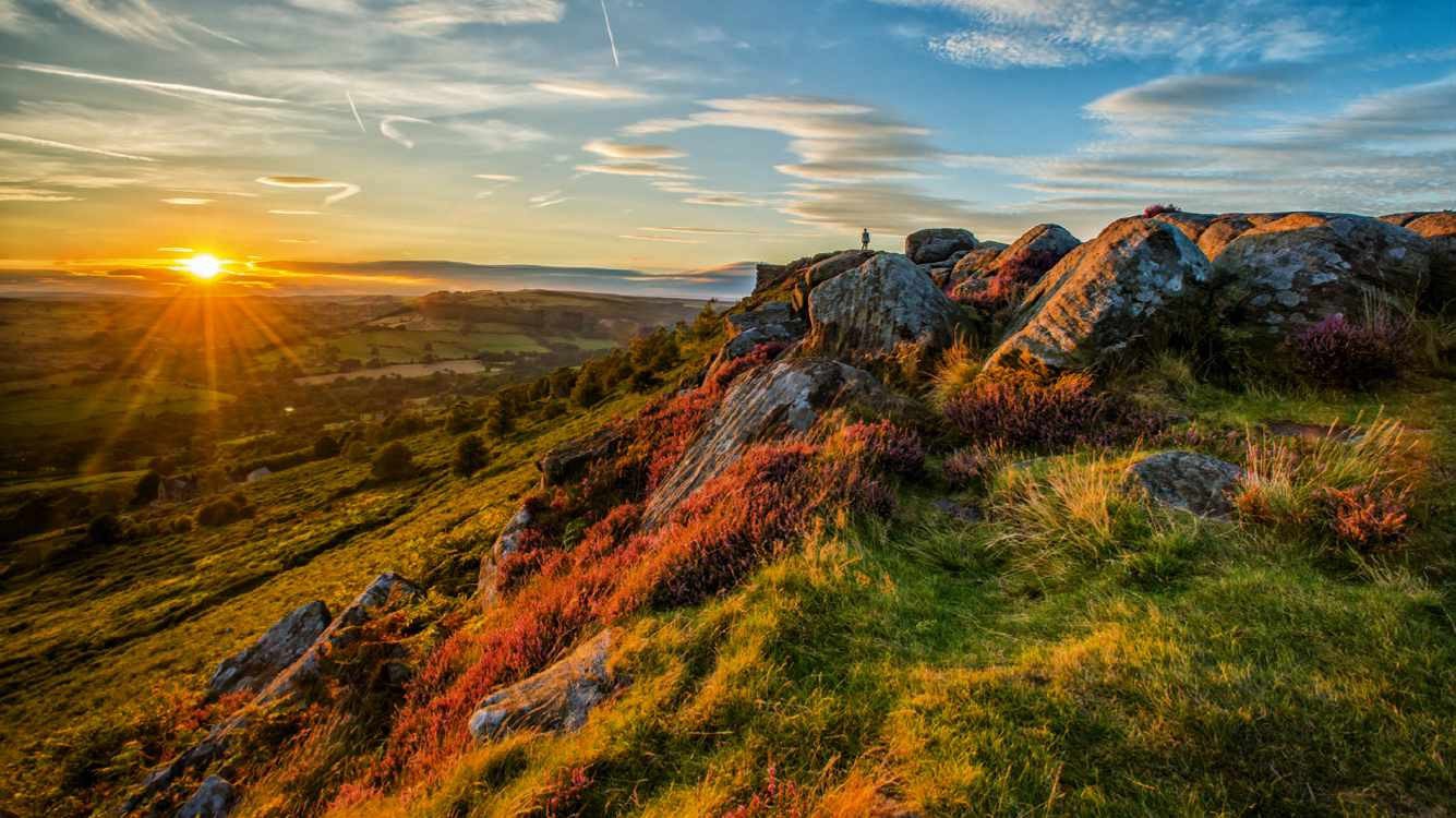
At Curbar Gap, the land drops dizzily to the Derwent Valley floor, the uplands on the other side stretching in front of you: Longstone Moor, Hucklow Edge, Sir William Hill, Win Hill, Howden and Derwent Edge and Kinder Scout.
These views accompany you on your ramble, with the rock piles on Curbar Edge adding drama to the scene. This is prime walking and climbing terrain. It is also home to majestic birds of prey: kestrels, buzzards, hen harriers and goshawks. When you descend to the River Derwent, you will experience a much gentler landscape of water, meadow and woodland. Both worlds are equally enchanting.
1. START
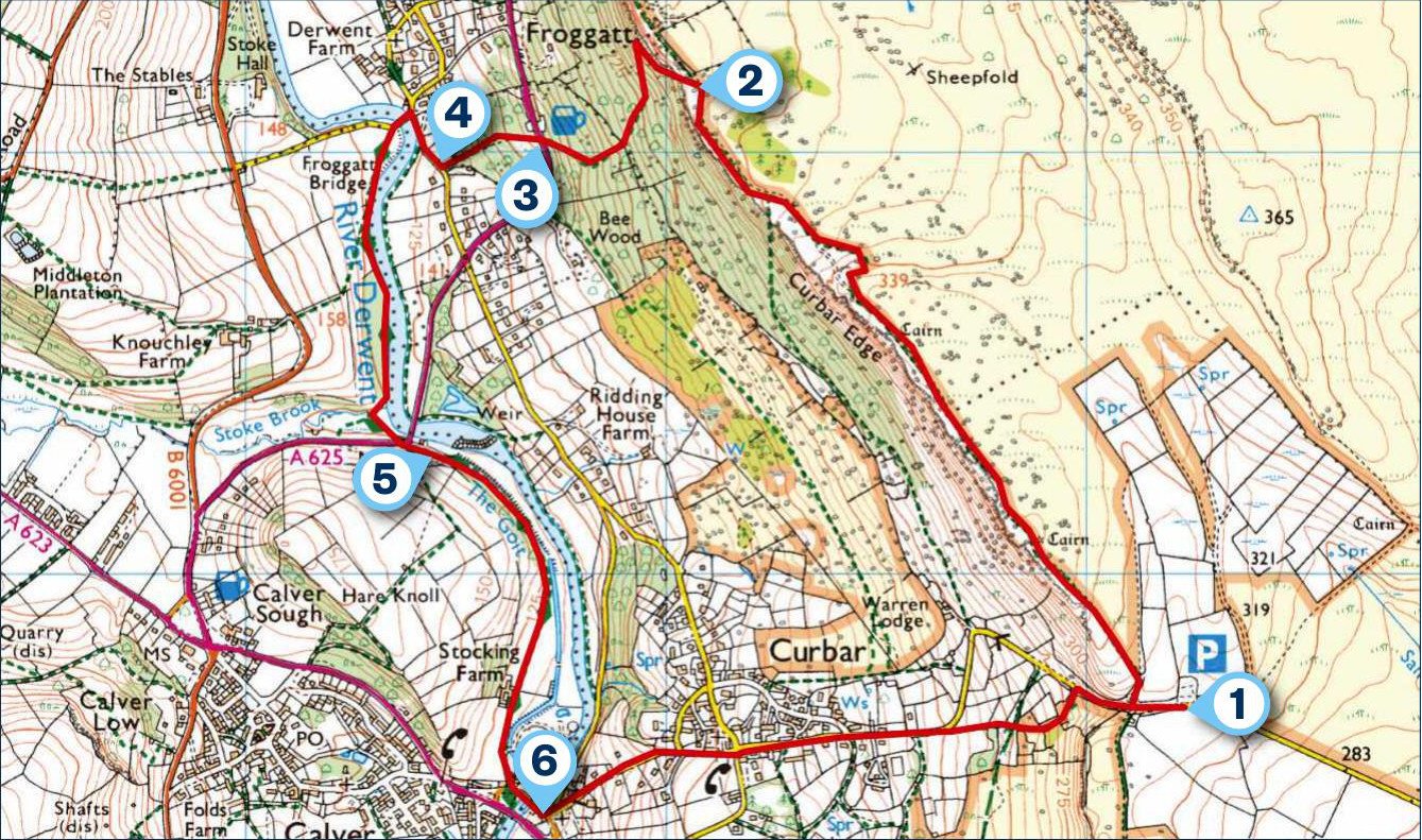
From Curbar Gap Car Park, take the steps up to Curbar Edge. There’s a wider path sitting back from the escarpment, but to appreciate the views and weathered rock formations, take the smaller paths beside the slabs.
2. 1.3 MILES
Once the path starts to descend, look out for a small signpost on the left (the second path descending the edge). It leads along the base of cliffs, often busy with climbers. Another left turn (not signed) drops steeply down through woodland a short way along the rockface.
3. 1.7 MILES
Where the route meets the A625, turn right to walk the road a short distance to the Chequers Inn for a pint or pub lunch. Otherwise, cross over and continue downhill to meet a second road: Froggatt Lane.

4. 1.9 MILES
Turn right on to it, then cross Froggatt Bridge, taking time to drink in the tranquil River Derwent and its waterfowl. At the other side of the crossing, follow the fingerpost on the left. The waterside path leads to New Bridge. Cross the road to continue along a track, the river on your left.
5. 2.5 MILES
You will pass the Shuttle House (once housing sluice machinery) and a striking S-shaped weir. The riverside path emerges from woodland on to meadow, leading to Stocking Farm with its old schoolhouse and bell tower. Head down the lane, passing the imposing Calver Mill. Reaching a road, turn left for the riverside Bridge Inn or right for the Derbyshire Craft Centre and Eating House.
6. 3.2 MILES
Opposite the Bridge Inn, Curbar Lane leads up through the eponymous village on to Bar Road. Just past the speed-limit signs, climb up through fields, cutting out the switchback of road. From here it’s a short climb up Clodhall Lane to the car park.
With a bit of luck, the vintage Jolly’s coffee van will be waiting with drinks after the ascent from the valley floor.
USEFUL INFO
Starting point
Curbar Gap Car Park (S32 3YR) fills up quickly, so arrive early if you can. There is a parking charge. The 257 bus service runs from Bakewell to Calver.
Terrain
Flat walking on the edge and by the river. There is a tricky descent off the escarpment.
Map
OS Explorer OL24
Eat/drink
Jolly’s takeaway at Curbar Gap Car Park on weekends. The Chequers Inn is open seven days. chequersfroggatt.com
In association with
