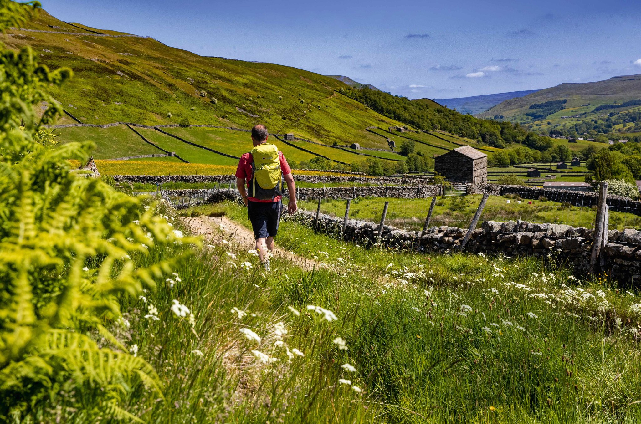
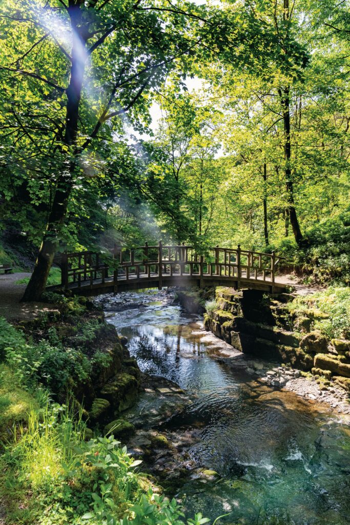
The Pennine Way
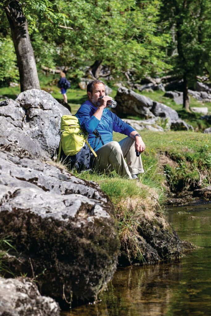
Looking to take on one of the world’s greatest walks this summer? Then trek the backbone of England – an epic trail over beautiful hills, via sparkling waterfalls, pretty villages and blooming wildflower meadows. Mark Sutcliffe reveals the best ways to explore the Pennine Way
Photos: Stephen Garnett
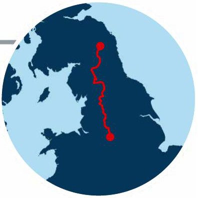
Quite simply, the Pennine Way is Britain’s most iconic National Trail – a 268-mile trek along the spine of England, traversing three National Parks and the North Pennines Area of Outstanding Natural Beauty.
Over 15–20 days, Pennine Way walkers will clock up the equivalent of 1.3 ascents of Everest, gained by scaling a succession of lofty summits and elevated plateaus across Northern England’s most spectacular upland terrain.
It isn’t the longest National Trail – that would be the 630-mile South West Coast Path, immortalised in Raynor Winn’s bestseller, The Salt Path. And it isn’t the toughest long-distance hike; that is widely acknowledged to be the Cape Wrath Trail – a 230-mile odyssey through some of the most remote wilderness in the Scottish Highlands. But it is the original designated National Trail and, to the tens of thousands of folk who have walked it, still the best – right up there with the world’s greatest hikes, such as the Appalachian Trail and El Camino de Santiago.
After walking the Pennine Way in 2010, Poet Laureate Simon Armitage summed up the experience with a characteristically pithy coda: “To embark on the walk is to surrender to its lore, and to submit to its logic, and to take up a challenge against the self.”
GETTING STARTED
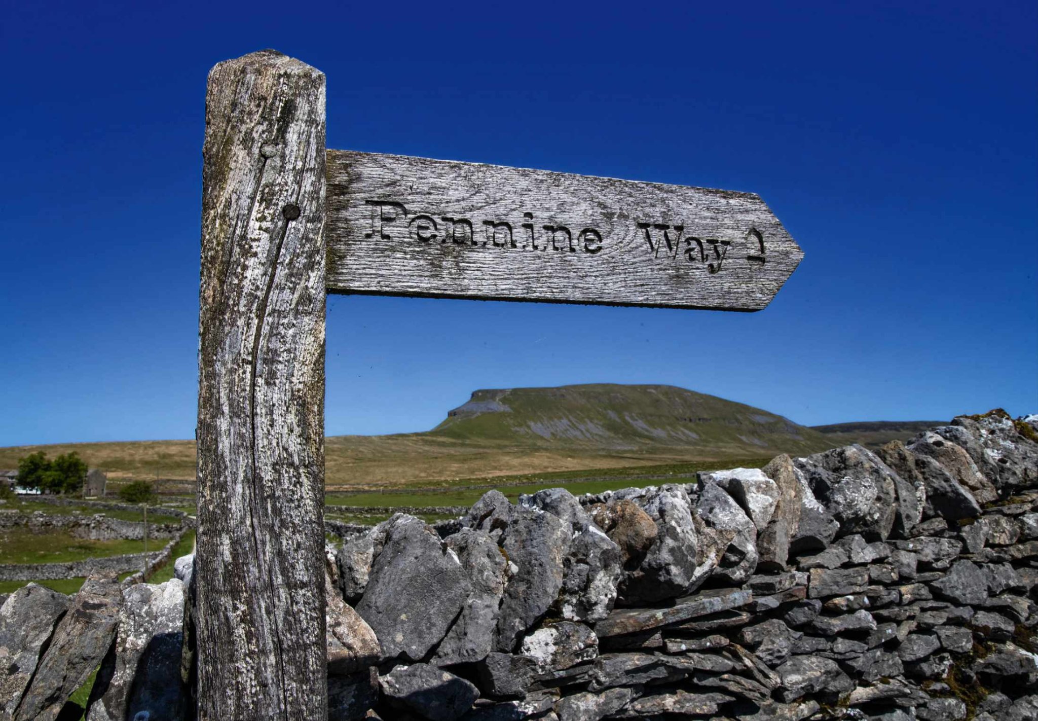
The Pennine Way starts – appropriately enough – at Edale in the shadow of Kinder Scout in the Peak District National Park. This was the backdrop for a series of mass trespasses in the 1930s. From Kinder, the route meanders for more than 250 miles through the northern uplands, traversing increasingly wild and remote terrain to reach the Scottish Border at the hamlet of Kirk Yetholm.
Which way to walk – from north or south?
It’s traditionally walked south to north, keeping the prevailing winds and weather at your back, but don’t forget to cast regular glances over your shoulder as some of the best views may be behind you. Daily distances vary from a mundane 11-mile schlepp over the moors above the mill towns of West Yorkshire to the challenging 22-mile trek from Greenhead to Bellingham via Hadrian’s Wall.
What are the best times of year to walk the Pennine Way?
The route is open all year, although the North Pennine sections can be impassable after heavy snow and covering up to 22 miles is challenging in eight hours of mid-winter daylight, even for the fittest of walkers. The best times of year are May and June, before the searing heat of summer, or September, when the boggier sections are at their driest.
How many days does it take to walk the Pennine Way?
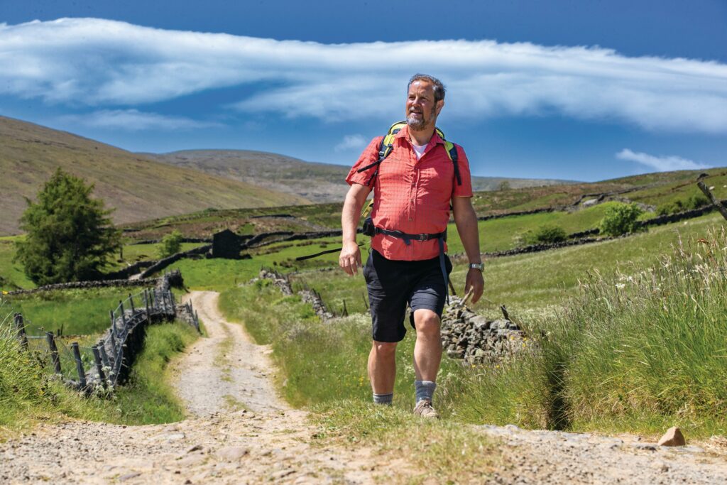
Most Pennine Way walkers split the route up into between 15 and 20 sections – although ultra-runners John Kelly and Damian Hall recently completed the entire distance in just two-and-a-half days of non-stop running. Many hikers complete the walk in ‘instalments’ of a few days or a week at a time. A growing ecosystem of tour operators now offer visiting walkers five, seven and 16-day package trips, which include pre-booked accommodation, luggage transfers and even professional guides if required.
WHY BOTHER?
For the thousands of folk who go the full distance, it can be a transformational experience, according to Pennine Way National Trails Partnership Manager Jo McAllister, who walks extended sections of the route every year.
“For the thousands of folk who go the full distance, it can be a transformational experience”
“The Pennine Way visits some truly spectacular natural wonders but, for me, it’s the lonely stretches away from the ‘honeypot’ destinations where people discover the true nature of the trail,” explains Jo.
“It may feel as though you are completely alone, with just the song of the skylark and plaintive call of the curlew for company, but actually you are walking in the footsteps of thousands of other people just like you and it’s only in the quieter places where you make this connection with those whose journey you are sharing.”
PENNINE WAY STAGES
A day-by-day guide to the trails and triumphs of the Pennine Way
DAYS 1 TO 8
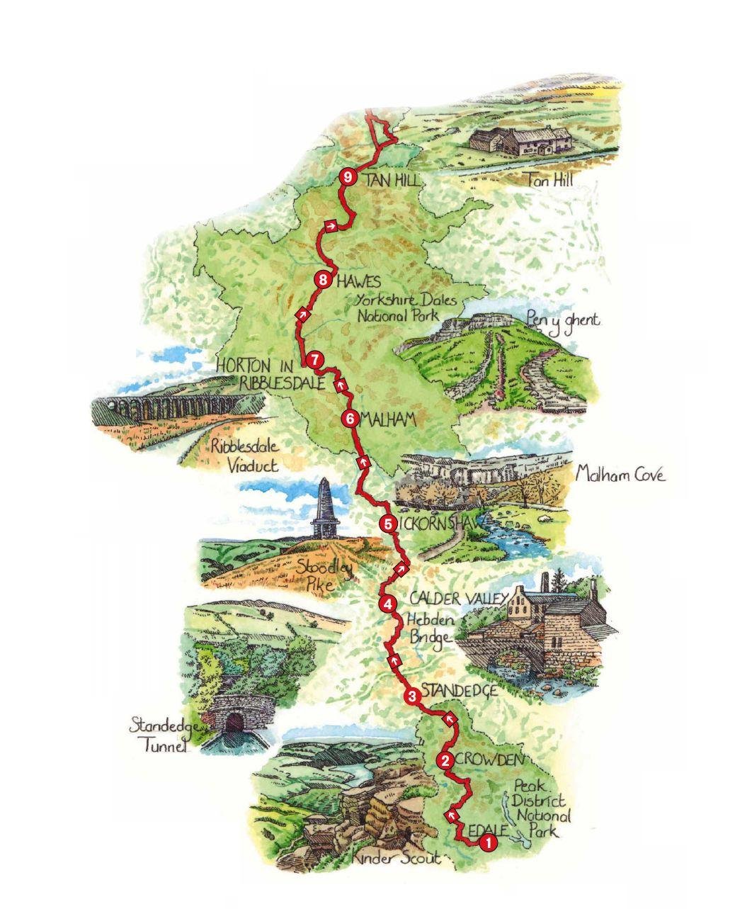
DAY 1
Edale to Crowden
16 miles (26 km)
Catch the train from Manchester or Sheffield to Edale and let the adventure begin! Forget any notion of easing your way into the trail; the first day is a tough climb up on to the Kinder Plateau, characterised by peat hags and eroded edges of millstone grit.
DAY 2
Crowden to Standedge
11 miles (18 km)
Today’s section is easier on aching legs, traversing lonely moorland punctuated with sparkling Pennine reservoirs. Footpath improvements mean the horrors experienced by Alfred Wainwright, who almost disappeared into one of the notorious peatbogs while walking this section in the 1960s, are unlikely to be encountered.
DAY 3
Standedge to Calder Valley
11 miles (18 km)
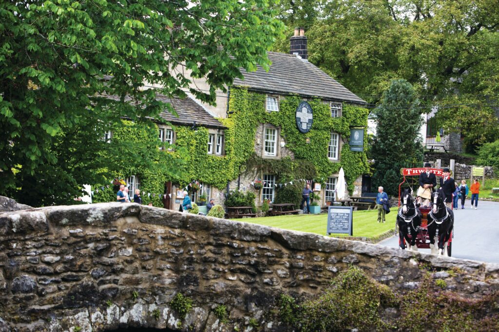
Today’s section cleaves closer to civilisation, with plenty of tempting diversions to sample local food and the vibrant culture of the Calder Valley. The distinctive pinnacle atop Stoodley Pike is a constant companion and the relatively modest distance allows plenty of time to explore the cafés and restaurants of Hebden Bridge.
DAY 4
Calder Valley to Ickornshaw
16 miles (26 km)
A longer hike today through the literary landscapes of Brontë Country, through Heptonstall Moor before dropping into the little village of Ickornshaw. There’s a wider range of accommodation and eateries in nearby Haworth – plus the added appeal of the Brontë Parsonage.
DAY 5
Ickornshaw to Malham
17 miles (27 km)
Today’s lengthy leg passes through the low-lying Aire Gap and, while there are plenty of options to buy provisions in the many towns and villages along the route, this makes navigation a little fiddly. This rather nondescript section marks the transition from industrial West Yorkshire to the stunning scenery of the Yorkshire Dales and the contrast is stark.
DAY 6
Malham to Horton-in-Ribblesdale
14.5 miles (23 km)
The first of the ‘classic’ days on the Pennine Way climbs on to the limestone pavements of the Dales to cross Malham Moor and tackle the gnarly scramble up Pen-y-ghent before a long, scenic descent to Horton-in-Ribblesdale.
DAY 7
Horton-in-Ribblesdale to Hawes
14 miles (23 km)
After the crowds at Malham, today is one of those lonely treks across vast landscapes that characterise the northern sections of the Pennine Way. There’s plenty of classic Dales scenery to enjoy along the route, with good views of the iconic Ribblehead Viaduct from Cam Fell before dropping into the delightful little town of Hawes.
DAY 8
Hawes to Tan Hill
16.5 miles (27 km)
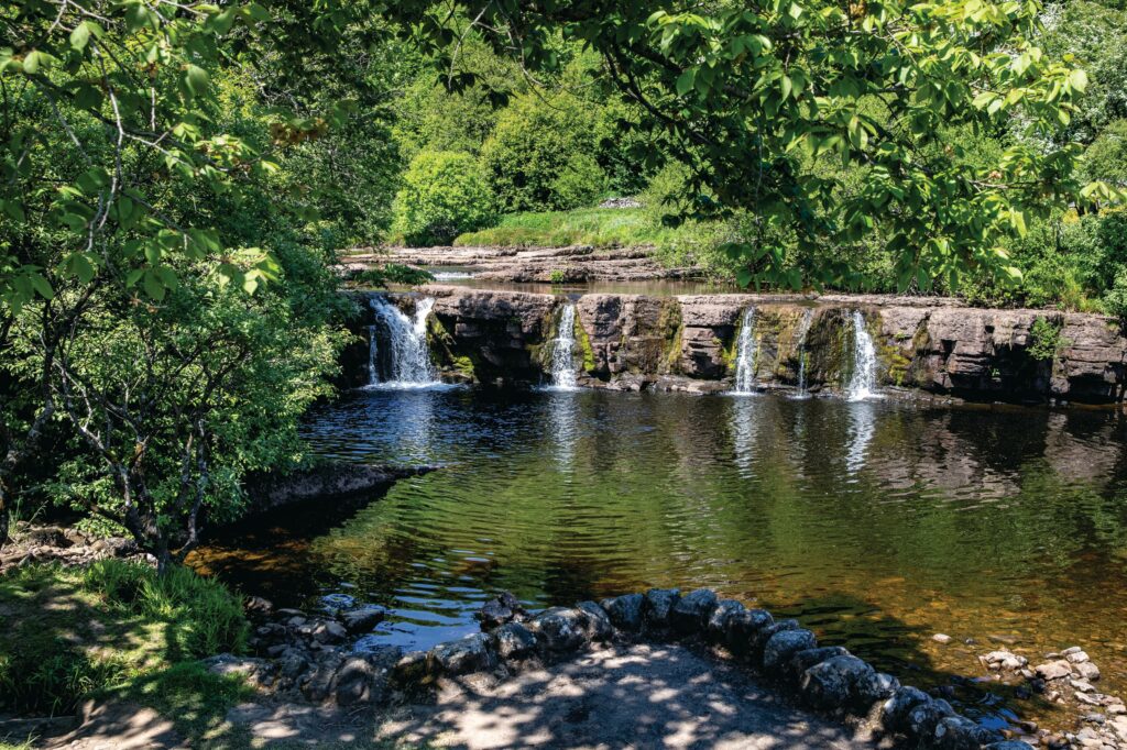
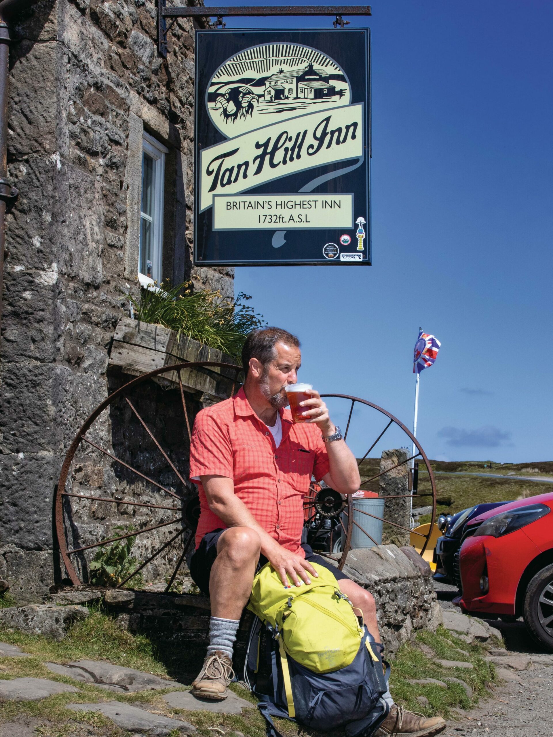
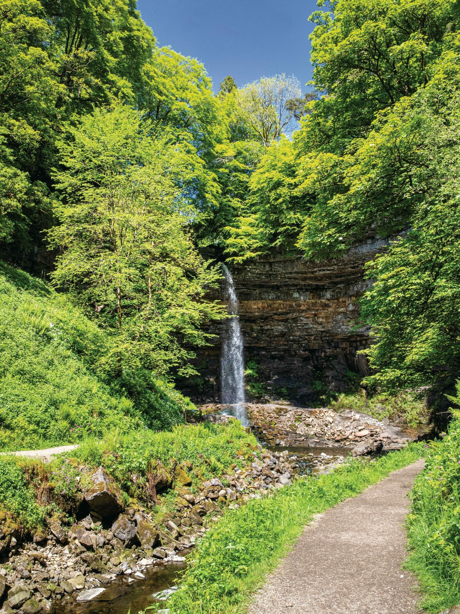
Another absolute classic day on the trail, with spectacular cascades, a big climb to Great Shunner Fell, one of the highest points on the route, before striding through a patchwork of wildflower meadows and drystone walls and winding up at the legendary Tan Hill Inn – the highest pub in Britain at 527 metres above sea level.
DAYS 9 TO 16
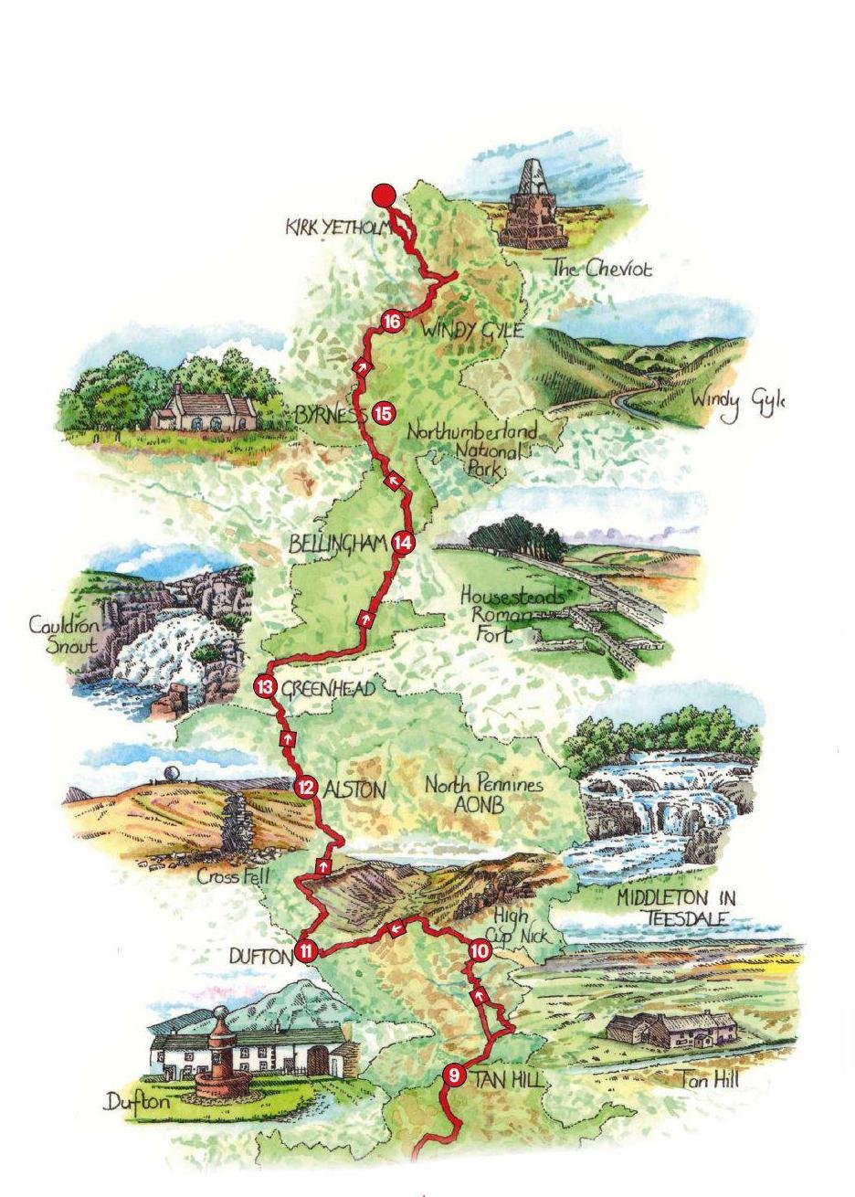
DAY 9
Tan Hill to Middleton-in-Teesdale
17 miles (27 km)
After the delights of Swaledale and Tan Hill, today’s trek offers an opportunity to reflect on progress to date while striding purposefully towards the halfway point on the trail. This section offers a foretaste of the wilder landscapes that lie ahead. Taking the Bowes Loop off the main route offers more accommodation options.
DAY 10
Middleton-in-Teesdale to Dufton
21 miles (34 km)
Get ready for the best day on the trail. This epic traverse of the Pennine ridgeline has it all – spectacular waterfalls, massive moorland views, a lot of climbing, some challenging navigation and the jaw-dropping scenic wonder of High Cup, as you – quite literally – enter Eden (the valley, that is).
DAY 11
Dufton to Alston
20 miles (32 km)
After the exhilaration of yesterday, today’s trek is an altogether more sobering experience. On a perfect day, the hike across the 914m massif of Cross Fell and its various subsidiary summits feels dramatic, but it’s a very long schlepp with sometimes tricky navigation, so plan your journey with care.
DAY 12
Alston to Greenhead
16.5 miles (26 km)
Following the excitement of criss-crossing the backbone of Britain, today’s walk is very much a transition trek, linking the North Pennines to Hadrian’s Wall country. The terrain is unremarkable – save for its unrelenting squelchiness – and navigation can be tricky. Worry not, things can only get better.
DAY 13
Greenhead to Bellingham
22 miles (35 km)
Another classic day on the trail, walking alongside Hadrian’s Wall for eight miles before heading north into Wark Forest. It’s a long day with lots of ups and downs and it’s worth considering a detour to overnight at Once Brewed to explore the nearby Roman Fort of Housesteads before continuing your journey.
DAY 14
Bellingham to Byrness
15 miles (24 km)
Stock up on provisions for another wild section with nowhere to stop for lunch – and precious little to discover when you reach your destination. This is a walk of two halves: moorland then dense forest. At just 15 miles, it’s an easy day ahead of the epic final legs.
DAY 15
Byrness to Windy Gyle
14 miles (22 km)
The Cheviots are England’s least-visited range of hills and today’s challenging stretch is a glorious hike through the remote southern reaches of this wonderfully wild landscape, dotted with Roman remains and echoes of the Border Reivers as you skirt the border with Scotland.
DAY 16
Windy Gyle to Kirk Yetholm
13 miles (21 km)
Prepare for a suitably epic finale to the greatest walk in England. Your legs may be aching and feet battered, but adrenaline alone should power you through this exhilarating last day. In good weather, the detour to the summit of the Cheviot is a must for the views to Scotland and to the Farne Islands in the east. Savour the final descent and celebrate in the Border Hotel, where you can collect your finisher’s certificate.
GREAT DAYS ON THE PENNINE WAY
MALHAM TO HORTON-IN-RIBBLESDALE
14.5 miles (23km)
3,000ft (1,000m) of ascent
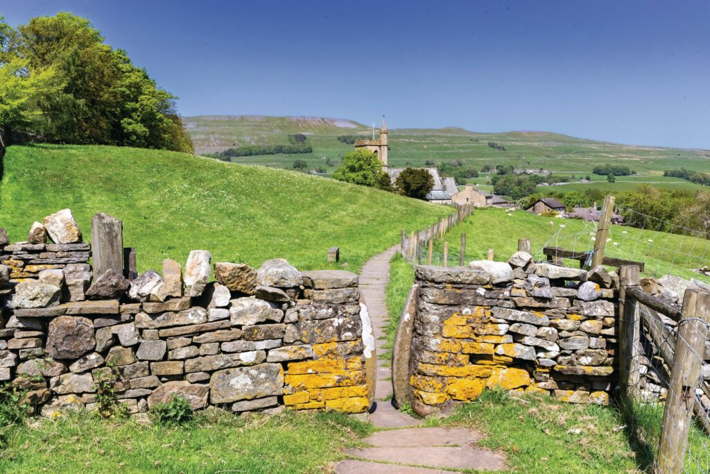
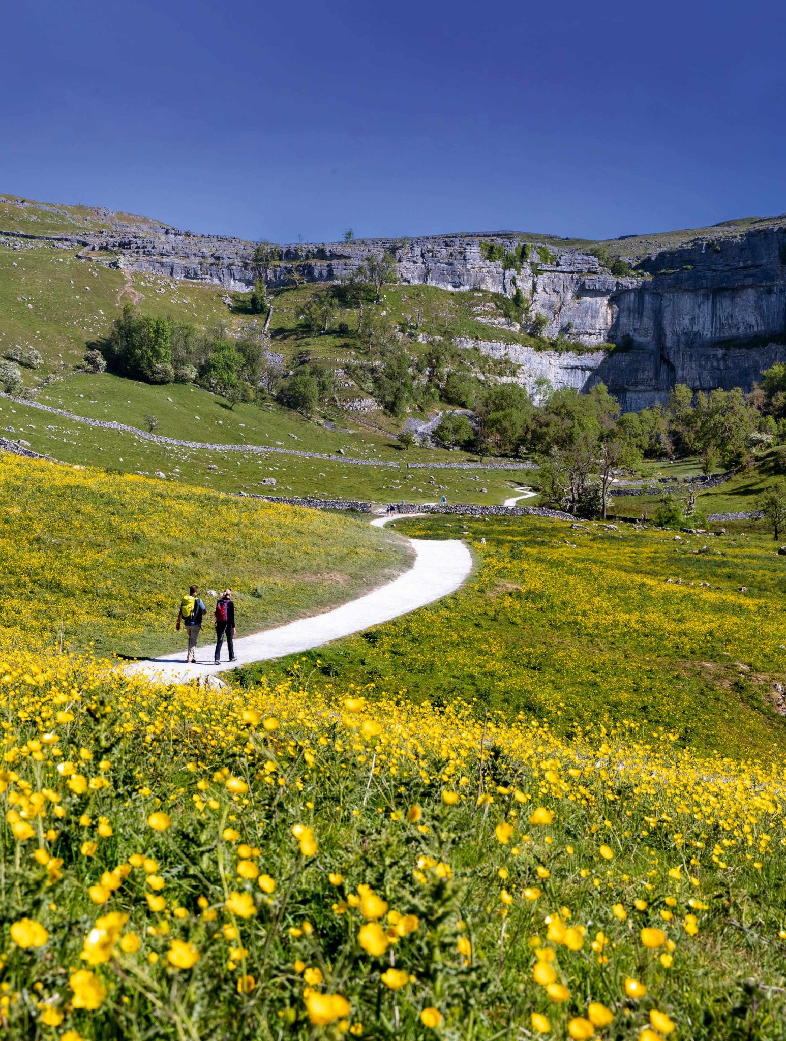
After the exhilaration of the first day up on Kinder Scout, the next few days on the trail are just a little bit mundane by comparison, but on day six the Pennine Way ups the ante as the trail hits the iconic limestone country of the Yorkshire Dales.
This is where it all began – when hundreds of hikers gathered in Malham for the official opening of the Pennine Way back in April 1965. Today, similar numbers descend on the picturesque village every weekend, but they are unlikely to walk much further than the famous cove.
This is my ‘go-to’ section for a quick Pennine Way fix and the starkly etched clints and grykes of this otherworldly limestone landscape never fail to captivate – even in poor weather, when the surroundings seem to grow in drama and stature.
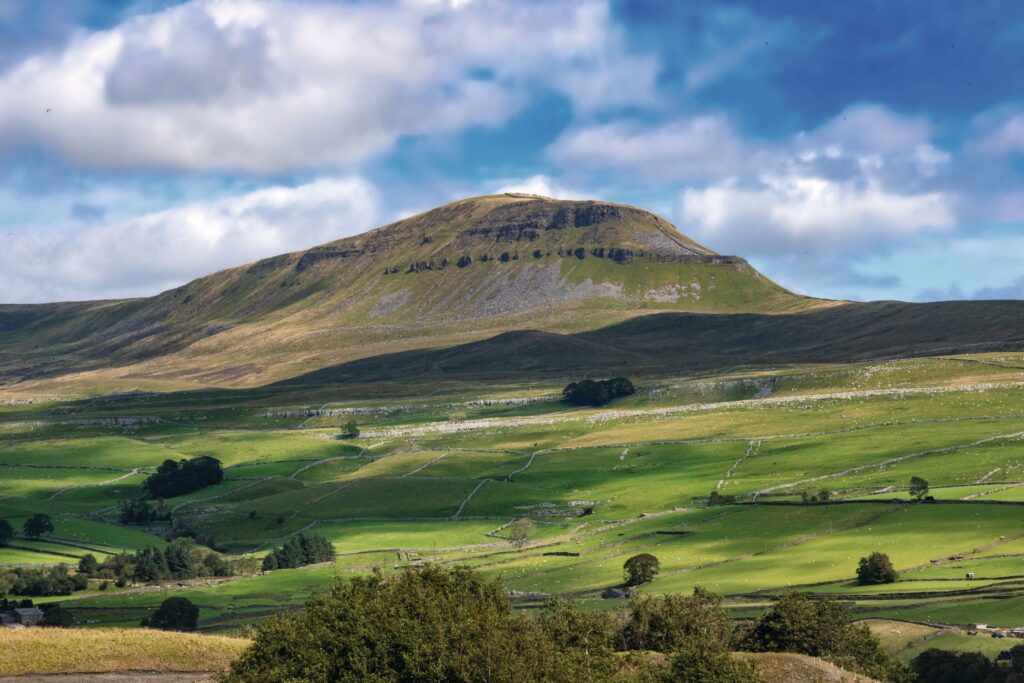
The path leads north, past tranquil Malham Tarn and over Fountains Fell into the glorious limestone uplands of Yorkshire’s ‘Three Peaks Country’ – named after the trio of 2,000ft (610m) mountains that dominate this landscape: Ingleborough, Whernside and Pen-y-ghent.
Be prepared for a busy start to the day as Malham has become an extremely popular tourist attraction in recent years, but beyond the steep steps up to the rim of the famous cove, the sightseers evaporate and you are soon left to your thoughts amid the cratered limestone uplands of the Dales, captivated by the lofty summits of the Three Peaks to the north and west.
Don’t worry, you’re only expected to scale one of them: Pen-y-ghent – the ‘hill of the winds’ – ascending via the scrambly southern ‘nose’ over a succession of eroded terraces that vaguely resemble the mesas of the American desert states. The climate here is anything but arid, however, and with virtually no shelter between Malham and Horton, make sure you are well provisioned for the journey. It’s a different story underfoot, where the limestone quickly absorbs any rainfall through its pores, fissures and shake holes, making for surprisingly dry but rugged walking country.
After negotiating the limestone pavements, crags and ghylls, the lengthy descent into Horton affords outstanding views of Pen-y-ghent’s siblings to the north, but don’t expect too much from the village itself. For a wider choice of accommodation and dining options, head to Austwick or Settle for the evening.
Stay: Broad Croft House B&B (01729 860 419, broadcrofthouse.co.uk)
MIDDLETON-IN-TEESDALE TO DUFTON
21 miles (34km)
2,200ft (675m) of ascent
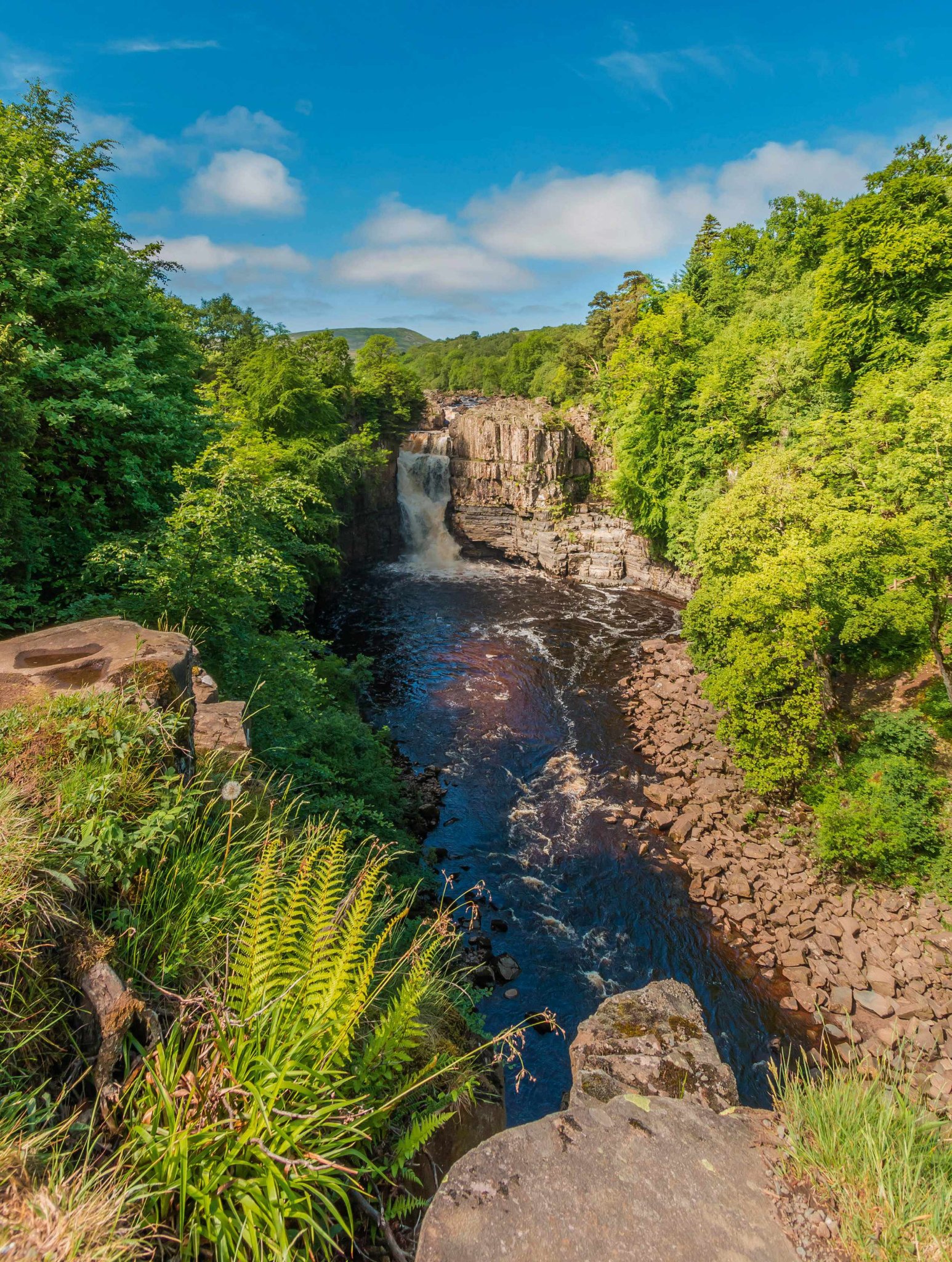
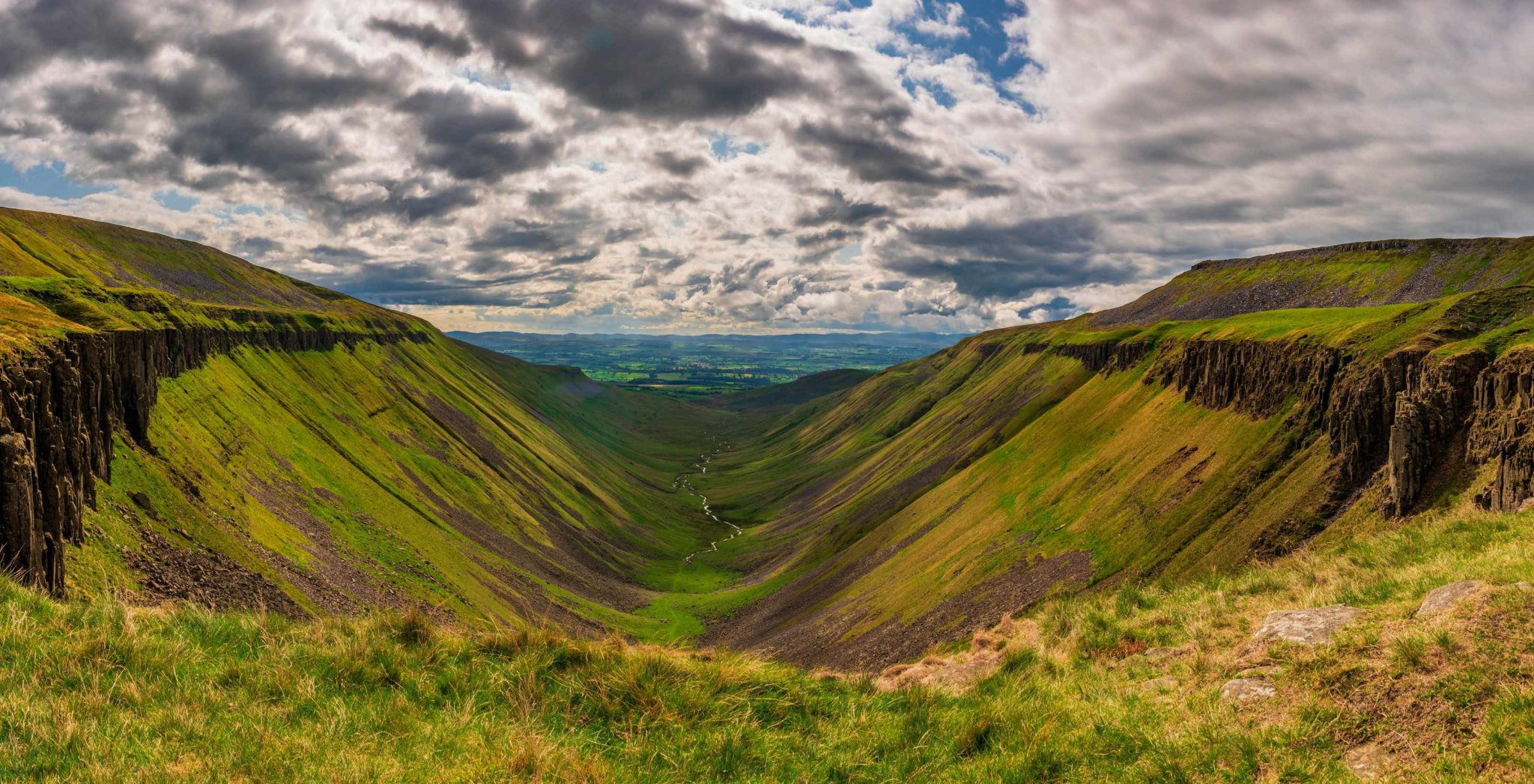
For many Pennine Way finishers, this is the incontestable highlight of the entire trek – a challenging 21-mile traverse of the Pennine Ridge from east to west, comprising spectacular waterfalls, tricky navigation, massive views of the Lakeland Fells and a glorious descent via one of the bona fide natural wonders of England.
Often referred to incorrectly as High Cup Nick (the ‘Nick’ is actually the gap in the dolerite sill at the head of the feature), High Cup is a mile-long chasm carved out of the western slope of the Pennine scarp. This almost perfectly symmetrical hanging valley – high above the fertile plain of the River Eden – has become known as the Grand Canyon of the North and with the Lakeland Fells looming on the western skyline, it’s a grand finale to one of the longest days on the trail.
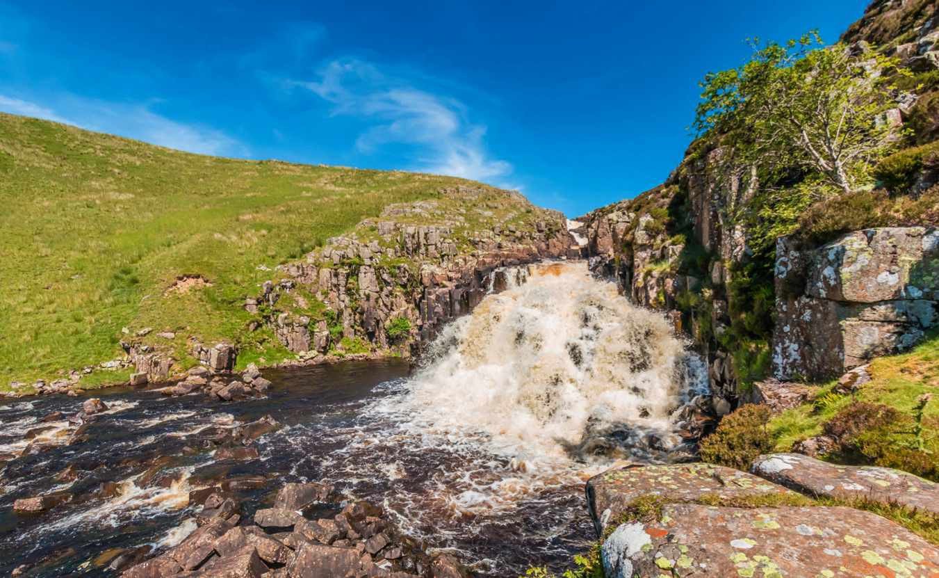
The River Tees, which rises on the plateau of Cross Fell – England’s largest expanse of land over 800m (2,625ft) above sea level – is your companion for the first few miles of the trail, which skirts the impressive falls of Low Force and High Force before threading its way into the deep chasm of Falcon Clints.
Scramble over the riverside rock formations to another stunning waterfall at Cauldron Snout, before striking out west across the exposed vastness of Dufton Fell, crossing the Pennines from east to west to the eastern escarpment of the Eden Valley. This is reputedly the snowiest place in England, with an average of 50 ‘snow days’ a year – another good reason for tackling the Pennine Way in summer. From here, the route skirts around Meldon Hill, tracking the Maize Beck before crossing the watershed and descending to High Cup.
Admire the huge views across the Eden Valley to the Lake District fells before striding out along the valley’s northern lip and the long descent into the pretty hamlet of Dufton, where a well-earned pint awaits you in the Stag Inn, a comfortable, walkerfriendly country pub. For a wider variety of accommodation and dining options, take a 15-minute taxi ride into Appleby.
Stay: Dufton Barn Holidays (01768 352 167, duftonbarnholidays.co.uk)
WINDY GYLE TO KIRK YETHOLM
13 miles (21km)
2,400ft (735m) of ascent
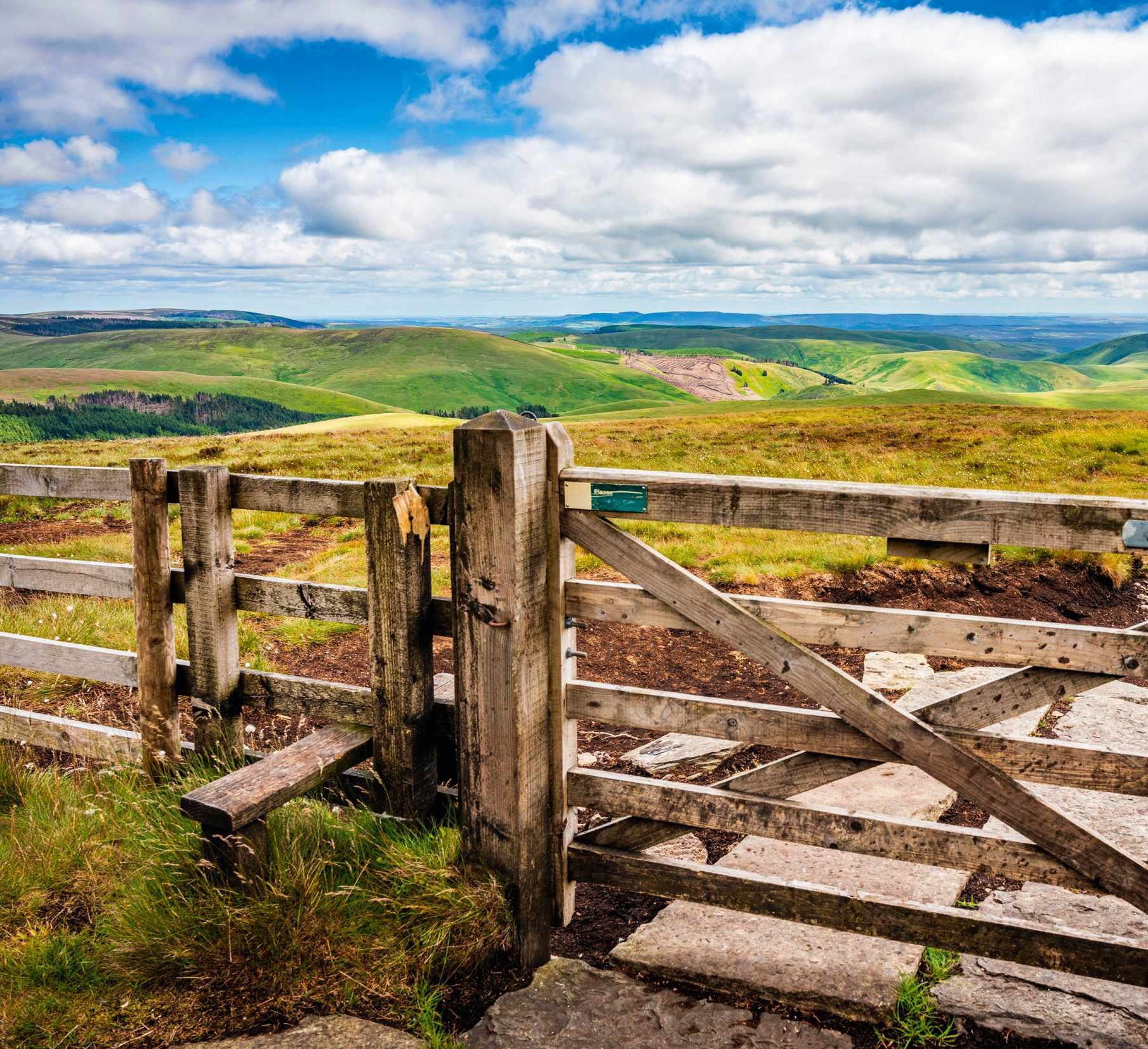
This fitting end to England’s oldest National Trail includes, according to its originator Tom Stephenson, the very best section of the entire route. The lofty traverse of the Cheviots – England’s most underrated mountain range – offers loneliness, seclusion and massive views, and skips between England and Scotland along a spectacular ridgeline. This is border country, where, after the Romans abandoned the northern frontier of their empire, lawlessness and anarchy prevailed for centuries. With only the spirits of the Reivers for company, the trail follows the border across a string of striking summits, providing unforgettable views to the north over the Scottish Borders.
Opinions vary markedly on this section of the trail: Stephenson was a big fan, while Wainwright was characteristically disparaging about it. Much depends on the weather and the level of fatigue felt by the walker. Some hardy souls attempt the last two sections of the trail in one marathon 27-mile yomp – which would perhaps explain the ambivalence towards the Cheviot detour. Our advice is to take your time and soak up the romance of this wild and lonely corner of England. The border along which you will walk today was largely porous for centuries and evidence of the Cheviots’ turbulent history is everywhere to see, with hill forts, Roman camps, burial cairns and ancient fortified settlements.
The trail’s finale starts with a steep ascent of the Cheviot ridge to Windy Gyle, followed by an exhilarating string of summits with far-reaching views in all directions. In perfect visibility, a detour to the cairn on the eastern edge of the Cheviot Plateau is worth it for the views to the east, otherwise stick to the ridge and admire the deep fissure of Hen Hole before climbing again to the perfectly conical summit of The Schil, Black Hag and White Law. From here, it’s pretty much downhill all the way to the bar at the Border Hotel in Kirk Yetholm.
Stay: The Tankerville Arms, Wooler (01668 281 581, tankervillehotel.co.uk)
CONCLUSION
The Pennine Way is on a par with some of the planet’s greatest long-distance trails. It’s a living tribute to the rightto-roam movement, along the rugged backbone of Britain.
Walking it in instalments is a practical way to complete the trail, but the best way to understand the Pennine Way’s unique character is to go the full distance in one epic hike – a serious undertaking for even the keenest hikers. While the Pennine Way visits some of the natural wonders of England – Malham Cove, High Cup and the Cheviot – these are separated by long tracts of remote upland. In these vast, elemental landscapes, the true nature of the trail is revealed, transcending modern noise and creating a deeper, more primal connection between those who walk it and the very soul of the nation.
Mark Sutcliffe is an outdoors writer and editor based in Lancashire. He specialises in active travel and sustainable tourism. salarmedia.com