SOUTH WEST
03 Gloucester Docks, Gloucestershire
Distance: 5.6 miles/9km | Time: 3 hours | Grade: Easy | Total ascent: 10m (return)

This walk starts and ends at Victoria Dock in the north-east corner of the main Gloucester Docks area. Here you will see many colourful canal boats, as well as the 15 warehouses around the Main Basin, which were originally built for storing grain.
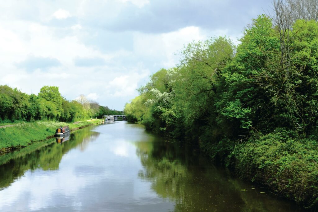
Before setting off, stop for refreshments at the Bake and Brew café. Energy reserves fuelled, head out on your walk, keeping a keen eye out for kingfishers and evidence of badger activity in the mixed woodland that lines the waterway.

1. START
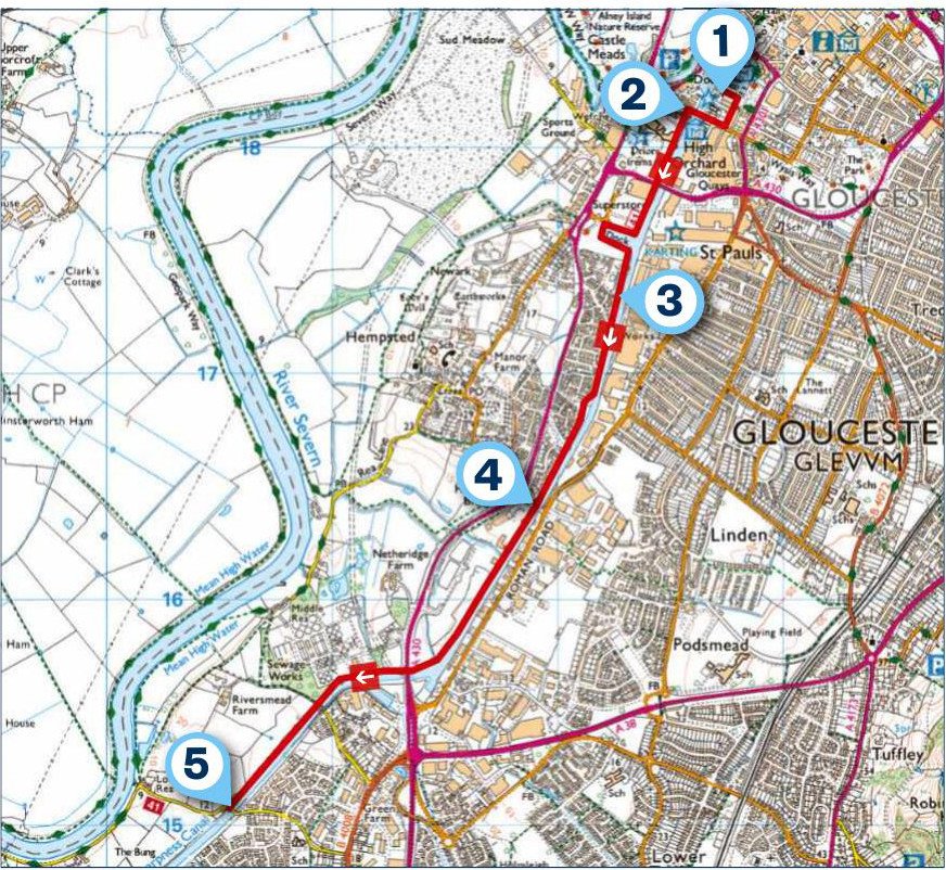
One of the most distinctive landmarks at Gloucester Docks is the 19th-century Mariner’s Chapel, where the walk begins. Built in 1849, the church served boatmen and sailors who arrived at the docks from inland waterways and overseas.
From the square in front of the chapel entrance, walk away from the building, then take the first right towards the Gloucester Quays shops to reach the ‘Welcome to Gloucester Quays’ archway. Go right here, cross the bridge and take the first left to join the Gloucester & Sharpness Canal. Opened in 1827, this 16.5-mile ship canal was once the broadest and deepest in the world.
2. 0.2 MILES
Follow the canal path south past Sula Lightship, a red steel vessel constructed in 1958 by Cook, Welton & Gemmel in Beverley, Yorkshire. To the right of this iconic ship is the Llanthony Secunda Priory, founded in 1136.
A little further on, pass beneath the High Orchard Lift Bridge and then loop around Monk Meadow Marina before reaching a little mixed woodland area. The birdsong medleys here are beautiful.
3. 1 MILE
Continue on the towpath, which briefly veers right uphill away from the canal, then left past another woodland area. Keep following the canal until you reach the Hempsted Swing Bridge.
4. 1.6 MILES
Pass the bridge and keep walking to reach Gloucester Rowing Club on your right. The path from here on sticks close to the canal, allowing you to really enjoy its beauty – look for kingfishers and other water-loving birds. When you reach Rea Swing Bridge, you have the option to extend the route to the village of Elmore. To do this, take the road on the right (Elmore Lane West) and follow it around a left-hand bend, being careful of traffic. Look for a footpath sign on the right, just before the private entrance to Stonebench House. Follow the Seven Way along the River Seven to Weir Lane, which leads into Elmore.
5. 2.8 MILES
Whether you extend the route or not, return to Gloucester Docks the way you came.
USEFUL INFO
Starting point
Pay-and-display car park, Southgate Moorings – Gloucester Docks Car Park. The nearest bus station is Gloucester Transport Hub, while national trains are available at Gloucester Railway Station. Both are very close to walk to the Gloucester Docks area.
Terrain
A mixed blend of paved and gravelled walkways along canal, woodland and meadow paths, with some medium road sections. All areas are wheelchair and pushchair friendly.
Map
OS Explorer 179
Eat/drink
Bake & Brew is a local coffee shop that can be found towards the left-hand side of Bill’s Dinner outside of Gloucester Quays.
Stay
Elmore Court has six new thoughtfully and sustainably made treehouses that overlook its 250-acre wetland and rewilding landscapes. Hire a treehouse from £250 per night. rewildthings.com/treehouses
