WALES
04 Pontcysyllte, Wrexham
Distance: 10.5 miles/16.9km | Time: 6 hours | Grade: Moderate | Total ascent: 273m

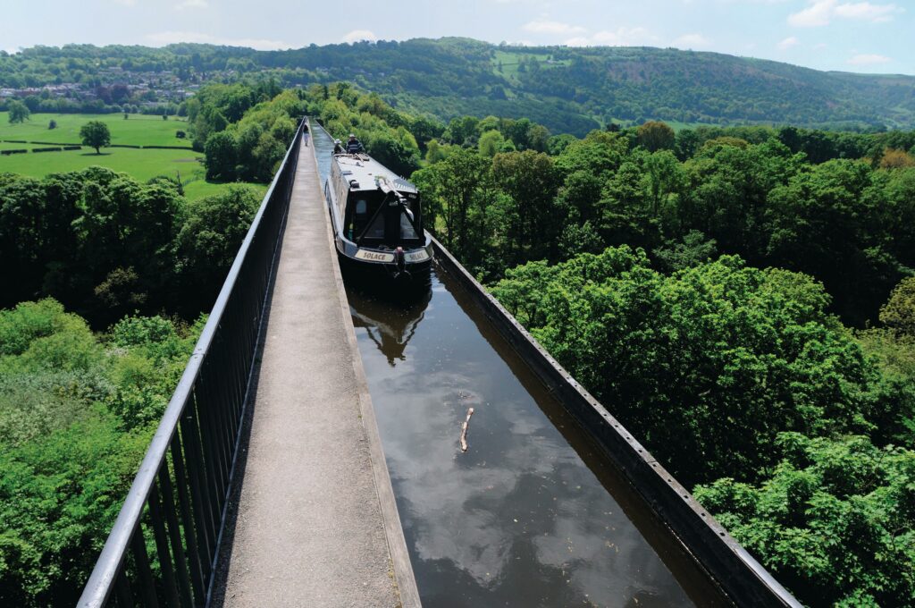
This spectacular circular walk, which links the Pontcysyllte and Chirk aqueducts of the UNESCO Llangollen Canal World Heritage Site, takes you through two tunnels and returns via the Ceiriog Valley and Offa’s Dyke Path.
Completed in 1805 and designed by architects William Jessop and Thomas Telford, Pontcysyllte Aqueduct spans 307 metres and rises 38 metres above the River Dee. Also awe inspiring, Chirk Aqueduct is 220 metres long.

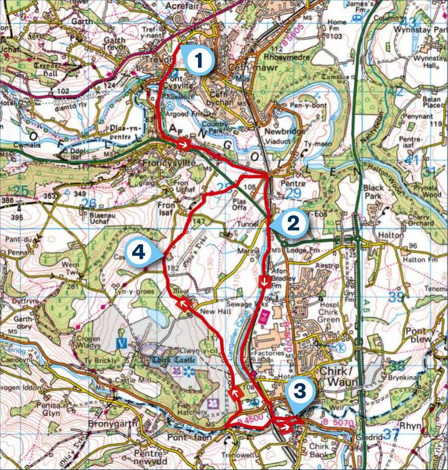
1. START
From the Pontcysyllte Aqueduct car park, join the path leading to Trevor Basin with is colourful narrow boats manoeuvring to and from the aqueduct. Continue along the airy towpath while enjoying views of the Dee Valley below. On the far side, pass moored boats and old lime kilns. Look left for views of the 45m high Cefn Viaduct.
After passing under two road bridges, you enter the 175m-long Whitehouse Tunnel, where the eerie darkness is accompanied by the ‘put-put’ sound of passing narrow boats.
2. 2.4 MILES
After leaving the tunnel, pass Chirk Marina and go through a wooded cutting to arrive at the 421m-long Chirk Tunnel. On emerging into daylight again, the towpath now crosses Chirk Aqueduct, with its views of the green Ceiriog Valley below. A railway viaduct looms to your right. At a bridge on the far side of the aqueduct, go up to a road and turn left. Pass the Bridge Inn and cross Chirk Bridge.
3. 4.7 MILES
Go through a kissing gate on the left and walk through a meadow beside the River Ceiriog. Look out for dippers and grey wagtails. Chirk Aqueduct will be in front of you. Go through a small gate to pass between its pillars and continue through a meadow to Pont Faen and the B4500. Turn right and soon take a footpath on the left.
At a fork, go left and pass a caravan site. Emerge on a lane at a bend and walk ahead (north), passing two lanes on the right and one on the left, to reach a point where Offa’s Dyke Path joins the lane.
4. 7.2 MILES
Continue ahead and take a right-hand fork. Pass more lanes and walk uphill to a kissing gate on the right. Take Offa’s Dyke Path through fields to a road. Cross it, turn right and soon go left on a track to a field.
The path will veer right, crossing Offa’s Dyke, to emerge on a road. Turn left over the canal and descend to the towpath where you bear right to retrace your steps to the start of your walk.
USEFUL INFO
Starting point
Pontcysyllte Aqueduct car park, off the A539, LL20 7TU (parking fee). Buses T3 (Wrexham-Barmouth) and 5 (Wrexham-Llangollen) stop on the A539, 300m from Trevor Basin.
Terrain
Canal towpath with aqueducts and tunnels, lanes and fields. Mainly level walking. Bring a torch to navigate the tunnels.
Map
OS Explorer 256
Eat/drink
The Bridge Inn, Chirk Bank is passed on the walk, and has a great location right by the aqueduct. 01691 773 213
Pontcysyllte Chapel Tearoom near Trevor Basin offers fresh coffee, breakfast and light meals. 01978 812 786, pontcysylltechapeltearoom.com
Stay
Wern Isaf Farm in Llangollen has room for tents, motorhomes and caravans. 01978 860 632, wernisaf.co.uk
