NORTH WEST
06 High Street, Cumbria
Distance: 6.1 miles/9.8km | Time: 4.5 hours | Grade: Challenging | Total ascent: 652m
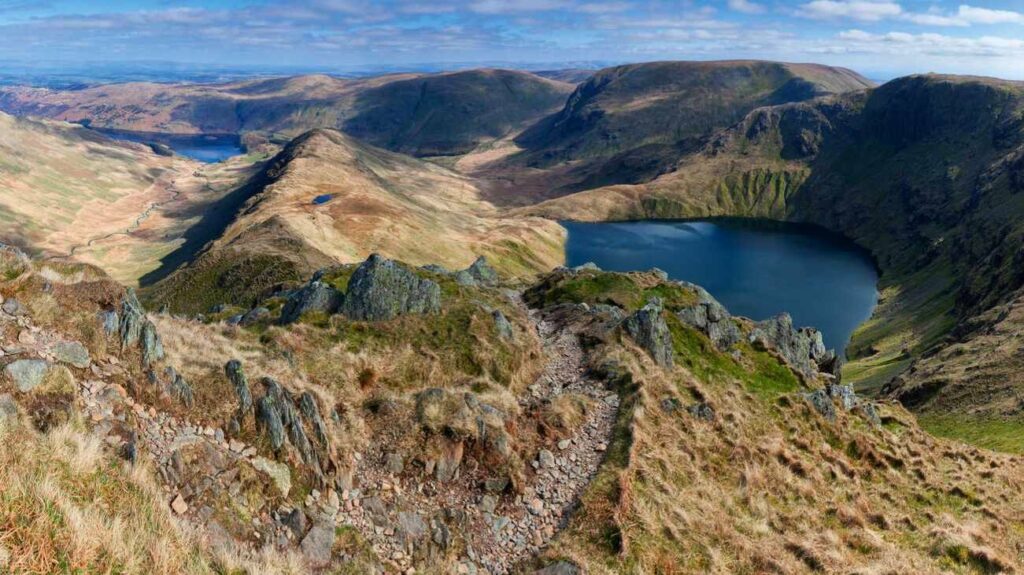
The road alongside Haweswater to Mardale Head car park feels like a route to isolation and wildness, far from the popular spots of Ambleside or Keswick. However, just below the surface, this area is full of human history. Haweswater itself covers the former village of Mardale Green, which was evacuated before the valley was turned into a reservoir in the 1930s.
Overlooking the lake is High Street, the highest peak in the Far Eastern Fells. Its summit was once used as a Roman Road, and later as a racecourse during summer fairs in the Victorian era.
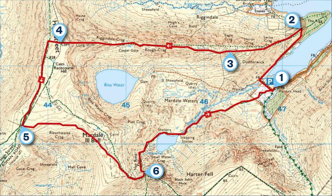
1 START
A 1930s Manchester Corporation Water Works footpath sign points the way from Mardale Head car park at the southern end of Haweswater. Follow this and, when the path divides into three, take the footpath to the right, crossing Mardale Brook before following the shore of Haweswater towards The Rigg. The path then strays slightly from the lake with a pine wood to the right.
2 0.7 MILES
When you reach a drystone wall at the top of the rise, take the path to the left and follow the wall in a westerly direction towards Riggindale Crag.
3 1.4 MILES
The path passes Eagle Crag, whose name now acts as a tombstone for the last golden eagles known to have lived in England. A small group had nested around Riggindale since 1969, but the last male died in 2015.
The path is steep and requires a bit of scrambling to reach the top of High Street, which stands 828m tall.
4 2.7 MILES
The area between High Street and Martindale to the north is home to one of the oldest red deer herds in the UK. They are particularly impressive to see and hear during autumn when they are in the midst of their annual rutting season.
From the top of High Street, join the bridleway on the far west side of the wall; follow it left (southwards) until the path itself crosses the wall, which turns a corner.
5 3.5 MILES
From the wall, turn left and follow the path in an easterly direction. The track is grassy and may be difficult to follow in poor visibility, so you will need good navigation skills here.
Continue along the path as it skirts Mardale Ill Bell, before dropping south-east to the Nan Bield Pass, notable for its stone shelter.
6 4.7 MILES
Take a left and follow the pathway down to Small Water. Follow the path around its northern shores and cross the stream at the stepping stones. Continue down the track back to the car park.
USEFUL INFO
Starting point
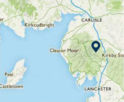
Free parking at the Mardale Head car park, CA10 2RP.
Terrain
Challenging in places with steep climbs and descents. Good navigation skills are required on the peaks in bad conditions as the paths may be difficult to follow.
Map
OS Explorer OL5
Eat/drink
Haweswater Hotel is a beautiful example of art deco design; a decadent place to eat/drink/sleep. haweswaterhotel.com

Photo: Alamy