NORTH WEST
09 Crummock Water, Cumbria
Distance: 7.3 miles/11.7km | Time: 4 hours | Grade: Moderate | Total ascent: 295m
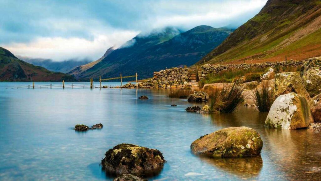
With a gauze of mist hanging lazily over its dark waters and the dying bracken providing a rusty backdrop, September is an enchanting time to visit Crummock Water.
In the woods, the canopy is taking on autumn hues, while red squirrels scamper about the floor, storing up food for the winter. On both sides of the lake, imposing fells rear up, adding drama to the scene. Buttermere is our starting point for the circuit of Crummock Water, but first we climb to the head of Rannerdale to enjoy a stroll down this hidden side valley…
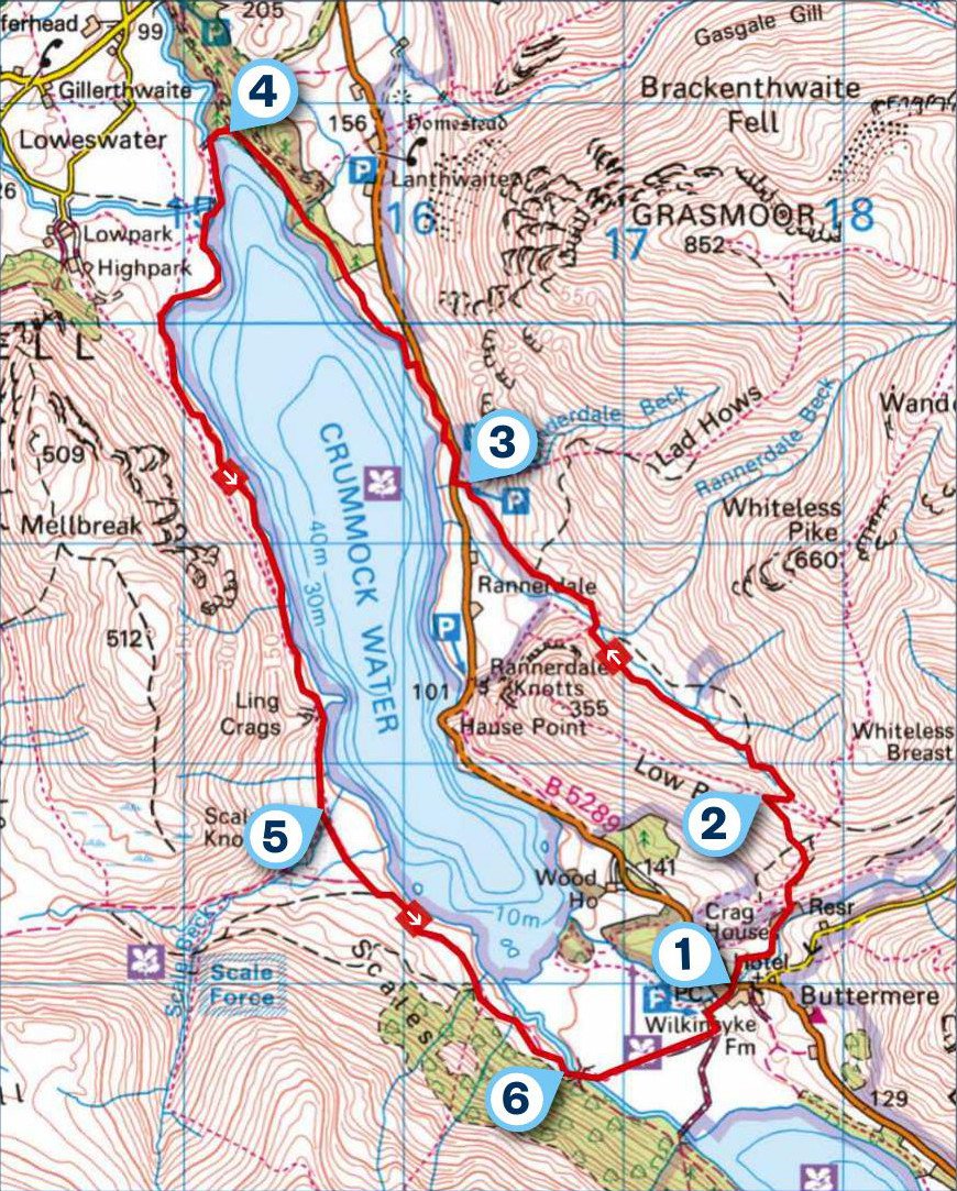
1 START
The small gate on the far side of the B5289, opposite the Bridge Hotel, provides access to an oak woodland trail with the subtlest hint of autumn about it. Leave via a gate and cross diagonally left, ascending a narrow trail. Keep right as another trail goes left. At the next junction, turn right, bear left at a fork and then go straight over a crossing of paths.
2 0.7 MILES
Reaching Rannerdale Knotts’ grassy ridge path, turn right and immediately descend left. Go left again at the bottom of the drop, now descending through the steep-sided valley of Rannerdale with Crummock Water ahead. Nearing the valley’s western end, go through a gate, cross the bridge and continue downstream.
3 2.1 MILES
About 0.6 miles beyond the bridge, ford a beck above a parking area. Drop to the road, turn right for about 190 yards and then go left through a kissing-gate. Descend beside a wall, soon following a lake path north. The open aspect gives way to wooded shores.
4 3.4 MILES
Approaching Crummock Water’s northern end, drop to some benches near the water’s edge. Continue beside the lake, crossing three footbridges, with improving views down the lake towards the High Stile range. After passing to the right of an old pumphouse, keep close to the lake. A gate at the far end of a shingle beach gives access to the damp western shore, directly beneath Mellbreak. On the lake’s far side is Grasmoor, its western face dissected by crags and gullies frequented by scramblers.
5 5.7 MILES
As the slopes to the right ease back, cross the first of two bridges. Beyond these, continue south-east across boggy ground, keeping about 200 yards back from the lake. Before long, a better path is joined. This crosses another two footbridges before finally parting company with Crummock Water.
6 6.8 MILES
Take the next turning on the left, crossing the waters of Buttermere Dubs. Follow the track to its junction with a wider one. Turn left to return to Buttermere village.
USEFUL INFO
Starting point
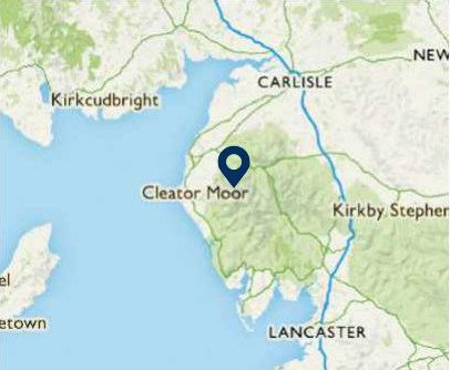
Bridge Hotel, Buttermere, CA13 9UZ. There are pay-and-display car parks in Buttermere and the village is served by Stagecoach bus 77/77A from Keswick (April to early November).
Terrain
Woodland, short climb up grassy hillside, lakeshore (boggy in places) and rough tracks.
Map
OS Explorer OL4
Eat/drink
There are several pubs and cafés in this village, including the Bridge Hotel. bridge-hotel.com