NORTH WEST
10 Blencathra, Cumbria
Distance: 7.5 miles/12km | Time: 6 hours | Grade: Challenging | Total ascent: 671m
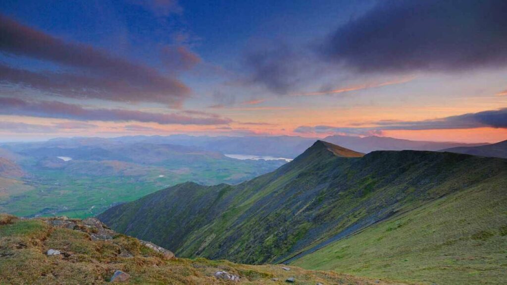
Blencathra, the 14th highest mountain in the Lake District, was one of Alfred Wainwright’s favourite fells, and it is easy to see why. “The sight of it at close quarters,” he said, “is sufficient to make a beholder about to tackle it forget all other worries, even a raging toothache.”
This stile-free circular walk takes in two of the 214 fells featured in Wainwright’s Pictorial Guide to the Lakeland Fells. Beginning at Blencathra Field Centre, the route climbs to the summit of Blencathra, dropping to Mungrisdale Common before contouring Blease Fell back to the start.
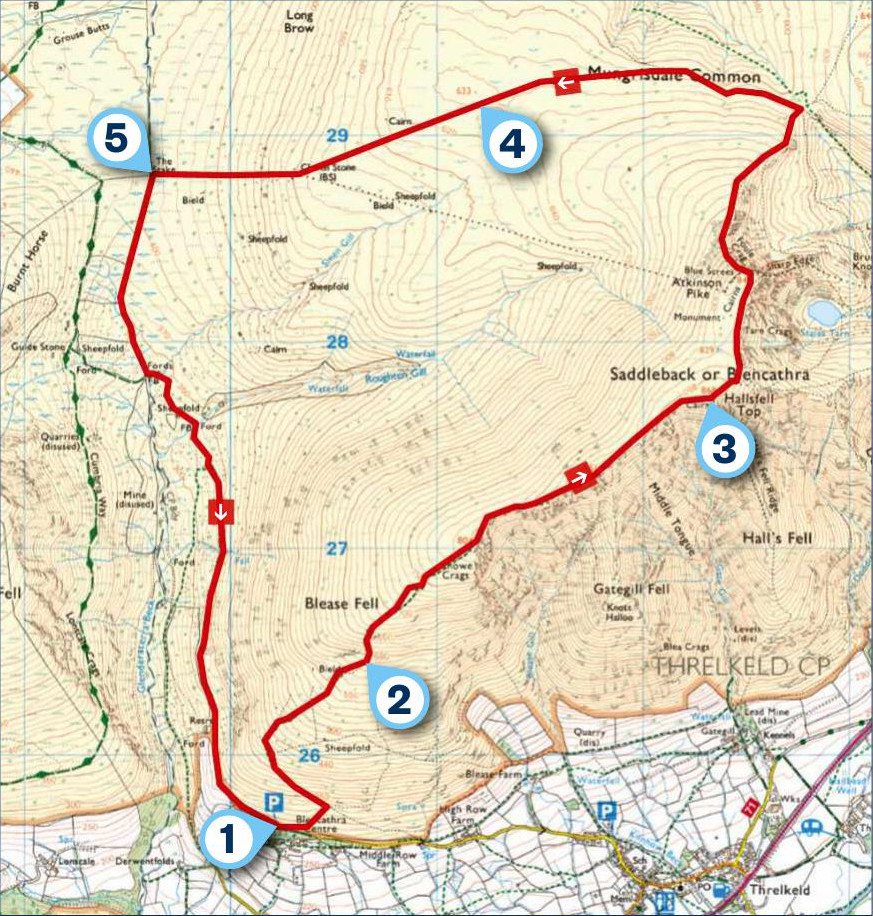
1 START
The walk begins from the parking area at the end of the road near Blencathra Field Centre. From here, follow the fingerpost that identifies the route to the summit. Turn left after 250m, following the path onto Blease Fell.. There are several switchbacks on the route uphill and at points the path is right on the edge of a steep slope. It is a good spot to stop and look around. The views stretch across Derwent Water, High Rigg and Grisedale Pike.
2 0.9 MILES
At about 600m above sea level, you reach the hardest part of the walk, climbing steeply towards Knowe Crag. After this point, the route follows the gentle contours of the ridge to Blencathra’s summit.
On a clear day, there are 360-degree views across the Lake District. Looking west, across Blencathra’s ridge, you can see Skiddaw, the Solway Firth and the Irish Sea. To the east, there are sweeping views across the North Pennines, and to the south are the Helvellyn Fells, Borrowdale and the Scafell Range. While to the north, beyond Bowscale Fell, is Scotland.
3 2.3 MILES
Follow the track north from the summit to the cairn at Atkison Pike, then begin the steep descent, on slippery slate gravel, to a meeting of paths on Mungrisdale Common. Turn left (west).
The route across Mungrisdale Common is only suitable for experienced walkers. In low cloud there are very few landmarks to follow, and there are many grassy paths, so good map skills are required. Check your navigation to ensure that you stay on route.
4 4.3 MILES
Mungrisdale’s summit is unmarked, and lacks the drama of Blencathra. Descend towards Cloven Stone, pass it, then continue downhill to The Stake. This section can be boggy, so pick your route carefully.
5 5.3 MILES
From here, turn left to meet Glenderaterra Beck and, soon after, a ford. Join the bridleway to the left, contouring Blease Fell back to the start.
USEFUL INFO
Starting point
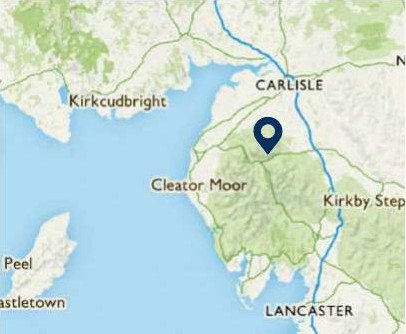
Drive past the entrance to the Blencathra Field Centre to the road end. Here there is free, off-road parking for about 12 cars. Please do not park in the field centre car park. For SatNav users, follow the postcode CA12 4SG.
Terrain
I climbed this route in my TerrainHopper – an all-terrain wheelchair which is designed for steep, rugged climbs. Around Mungrisdale the ground can be boggy. This route is only suitable for an experienced driver of an all-terrain wheelchair and the driver must be confident in the machine’s capabilities.
Map
OS Explorer OL5
Eat/drink
Both The Horse and Farrier Pub in Threlkeld (horseandfarrier.com) and the Threlkeld Community Café (threlkeldvillagehall.org) are wheelchair accessible.
Stay
Self-catering accessible accommodation at Irton House Farm,Isel Cockermouth. irtonhousefarm.co.uk